


Mapping
New Mapping Tools Shows How to Access Activities by Various Modes
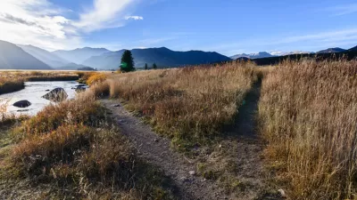
The Urban Accessibility Explorer is an easy-to-use mapping system that measures the number of activities that can be reached by residents of specified neighborhoods within a given amount of travel time, by a particular mode and time of day.
Friday Eye Candy: Full-Color, HD Videos Taken from Space
For the first time, full-color videos of the earth's surface will be made available to the public, with added options for paying customers. The imagery comes from two cameras on the International Space Station.

Mapping the Age of Every Building in Los Angeles
Developed using open data from local government sources, built: LA is a mapping tool that displays the age of every building in the county. Much of the area's built environment is surprisingly old.

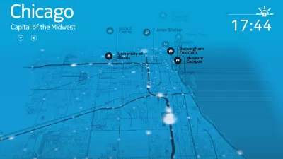
The Man Who Made Chicago Easy to Navigate
Edward Brennan waged an extended turn-of-the-century campaign to clean up Chicago's then-confusing address numbering system. Though few recognize his name, Brennan's legacy lives on in modern Chicago.

China Submerged: Mapping Nightmare Sea Levels
Cartographer Jeffrey Linn has compiled maps of how coastal China would look under risen seas. Over 40 percent of the country's population lives in potentially affected regions.

An App for California State Parks
California's Department of Parks and Recreation is getting into the app business. It is hoped that CaliParks will help improve access to the state's parks for young people and minorities.

Los Angeles and the Getty Launch Historic Places Database
Confirmed: Los Angeles really does have a rich history. HistoricPlacesLA, a new online database, provides detailed information on the city's historic sites.
San Francisco Resets the Bar with New Online Approvals Database
The online documentation of the San Francisco Planning Department's approval process received a huge upgrade.
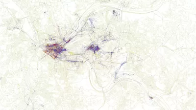
Friday Eye Candy: Maps Reveal Differences in How Locals and Tourists See the City
The cities that visitors see will always be different than the city that locals see. A new mapping project reveals the distinctions between the local perspective and the tourist perspective for 136 cities around the globe.
CityMap Expands to the Global Stage with its Social Mapping System
The owners of CityMap call it one of the most social and most monetizable maps in the world. With a new expansion plan announced this week, the app—which launched in 2012 with a map of every shop in New York City—is going global.
Mapping Income Inequality on D.C.'s Metro Lines
MIT's You Are Here mapping and data visualization project has produced a map of income levels, as tracked by the routes of the Metro subway system in Washington D.C.
Mapping the Knowledge Domain of Planning
Tom Sanchez and Nader Afzalan explore the age old question, "what is planning?" in their new report published earlier this week.
What's Missed When Taking the Scenic Route?
An app that plots the most beautiful route across cities made news earlier this month, but one commenter worries about how taking the more scenic route could make it harder to improve quality of life in the "less-than-scenic" sections of cities.
An App that Calculates the Most Beautiful Route
New in flaneur-enabling technology: a team of intrepid aesthetes in Barcelona is working on a new app that would advance GPS mapping tools by providing the most beautiful route to a destination, rather than the shortest or least congested route.
Location as Currency: Mapping Apps Will Optimize Indoor Navigation
"Location is the new cookie," says Simon Thompson of Esri, referencing the software in a browser that tracks the websites people visit. Meet the new apps making it happen.
Mapping the U.S. Mexico Border Fence
Journalists at the Center for Investigative Reporting undertook the herculean task of mapping the extent of the secretive and sometimes strange fence between the United States and Mexico.
Tracking Chicago’s Potholes
A new animated map presents the reported cases of potholes in Chicago since November—the maps colorful and provides insights into how the city, and our relationship to it, can change with time.
Mapping Transit "Deserts": An Imperfect Science
The first step to solving the transit “desert” problem is identifying where those deserts are. But that’s easier said than done.
The Best Maps of 2013
GIS Lounge is back with its list of the "most interesting and best" maps of the year. This year's honorees make traffic flows come to life, track global bike share inventory, and visualize regional differences in American speech.
NYC and Tech Community Work Together to Perfect Mapping Data
A partnership between the NYC Department of Information Technology and Telecommunications (DoITT) and OpenStreetMap is a promising example of the public sector and tech communities working together to improve the accuracy and usability of data sets.
Urban Design for Planners 1: Software Tools
This six-course series explores essential urban design concepts using open source software and equips planners with the tools they need to participate fully in the urban design process.
Planning for Universal Design
Learn the tools for implementing Universal Design in planning regulations.
Heyer Gruel & Associates PA
Ada County Highway District
Institute for Housing and Urban Development Studies (IHS)
City of Grandview
Harvard GSD Executive Education
Toledo-Lucas County Plan Commissions
Salt Lake City
NYU Wagner Graduate School of Public Service


