


Maps
Take a Digital Tour of Pennsylvania's Urban Waterfronts
Keystone Crossroads has produced an interactive series about Pennsylvania's urban waterfronts. A storymap and in-depth reporting provide waterfront access from afar.
The Importance of Geographic Literacy
Maps are still an important tool in teaching kids to be global citizens.
New App from the U.S. EPA Maps Environmental Justice
A publicly available web tool allows access to maps that overlay environmental impacts and the populations they impact (or the populations that manage to avoid such impacts, for that matter).
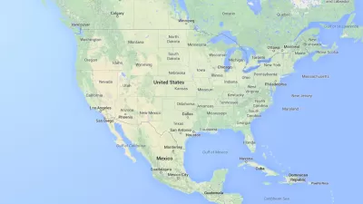
Friday Eye Candy: Map Shows Every Job in the United States
Looking for granular illustrations of the details of local economies? Look no further.
Exploring Vermont's Ancient Roads
Act 178, approved by Vermont in 2006, required that all ancient roads be catalogued by July 1, 2015 to be included in the state map. The exploration of old roads leading up to that deadline makes a compelling story.
Geospatial Technologies for a Healthier, Sustainable, and Increasingly Urban Earth
Penn IUR Co-Directors Genie Birch and Susan Wachter write about the promise of geospatial technologies in promoting sustainable urbanization.

An Animation of the World's Transit Systems
"A German university student has developed a fun new tool for visualizing public transit in a more system-oriented way," according to a post by Sam Sturgis.
USGS Map Archive Now Easily Accessible
The U.S. Geological Survey has introduced topoView, an intuitive map-based tool making it far simpler to search and access its archive of 178,000 topographical maps dating from 1880 to 2010.
Friday Eye Candy: Maps as Pop Art
A creative cartographer has created a series maps in the cartoon style of pop art.
Mapping Chicago's 375 Tax Increment Financing Projects
A new mapping project allows new access to information about Chicago's controversial tax increment financing mechanism. Now at least the debate will include visuals.
Where D.C.'s Metro Brings in the Most Money
A newly released map shows which stations in the Metrorail system bring in the most revenue for the Washington Metropolitan Area Transit Authority (D.C. Metro).
Farewell to the Trusty Map Book
From the years roughly spanning the invention of the automobile to the invention of the smartphone, every driver in Los Angeles traveled with a Thomas Bros. map book. Those days are gone, but nostalgia for physical maps remains.
Friday Eye Candy: Mapping the Country's Seasonal Bloom
Wondering when and where spring will bloom? The U.S. Forest Service has just the map to lead you to the fruits of your seasonal desires.
Pop Quiz: Can You Recognize Cities by Their Bike Lane Network?
Friday fun in the form of a mapping challenge from the Washington Post's Wonkblog.
Friday Eye Candy: Subway-Style Maps That Explain Everything
Ok maybe not everything, everything—but the recognizable tropes of subway maps do make it easier to explain everything from the development of cities to musical styles to interstellar scale.
A Song for (Almost) Every City
An intrepid developer has combined the powers of OpenStreetMap, Wikipedia, and Spotify to map 7,681 songs about 212 cities across the globe.
200 Years of Faster Travel Times
A post on Vox collects a series of maps from the "Atlas of the Historical Geography of the United States" showing how travel times changed over the past 200 years of U.S. history.
Visualizing the Spread of the OpenStreetMap Project
OpenStreetMap has released an animated map to illustrate the impressive growth of the project over the first ten years of its existence.
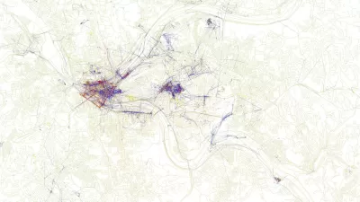
Friday Eye Candy: Maps Reveal Differences in How Locals and Tourists See the City
The cities that visitors see will always be different than the city that locals see. A new mapping project reveals the distinctions between the local perspective and the tourist perspective for 136 cities around the globe.

Friday Funny: How to Fail at Maps
It's too bad there isn't a map that can lead us to the place where all the fact-checkers have gone.
Urban Design for Planners 1: Software Tools
This six-course series explores essential urban design concepts using open source software and equips planners with the tools they need to participate fully in the urban design process.
Planning for Universal Design
Learn the tools for implementing Universal Design in planning regulations.
Heyer Gruel & Associates PA
Ada County Highway District
Institute for Housing and Urban Development Studies (IHS)
City of Grandview
Harvard GSD Executive Education
Toledo-Lucas County Plan Commissions
Salt Lake City
NYU Wagner Graduate School of Public Service


