


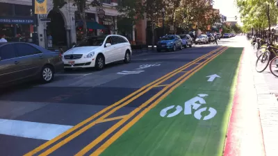
Friday fun in the form of a mapping challenge from the Washington Post's Wonkblog.
Emily Badger and Christopher Ingraham follow up on a post from earlier in the week that put bike infrastructure gaps in perspective by showing maps of bike routes removed from the filler of the auto-oriented street grid.
The original post included maps of the bike lane networks in Washington, D.C., Boston, Miami, and Seattle. A few intrepid bike and map enthusiasts even made more versions of cities around the world.
Then for a bit of fun, Badger and Ingraham transformed the map post into a pop quiz, of sorts, to challenge our mental maps. With the benefit of having read the post earlier this week and having most of this post written when I took the quiz, I scored 11 out of 11, earning myself a "Wow A+++!"
FULL STORY: Quiz: Can you identify these cities by only looking at their bike lanes?

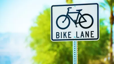
Pop Quiz: Name the City Based on its Cycle Lane Icon
The Guardian has a new pop quiz that will test the knowledge of urban aficionados that tend toward two-wheeled forms of transportation.
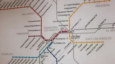
Pop Quiz: Can You Name Cities from their Transit Maps?
What better way to wind down from a long week thinking about cities and maps and transportation than by taking a quiz to show off your knowledge of cities and maps and transportation?
Houston Mayor Promises Dedicated Austin Street Bike Lane After Public Backlash
Although the one-way bike lane won’t be protected by physical barriers, the proposal is an improvement over the mayor’s initial plan to only include sharrows on the Austin Street project.

Alabama: Trump Terminates Settlements for Black Communities Harmed By Raw Sewage
Trump deemed the landmark civil rights agreement “illegal DEI and environmental justice policy.”

Study: Maui’s Plan to Convert Vacation Rentals to Long-Term Housing Could Cause Nearly $1 Billion Economic Loss
The plan would reduce visitor accommodation by 25% resulting in 1,900 jobs lost.

Planetizen Federal Action Tracker
A weekly monitor of how Trump’s orders and actions are impacting planners and planning in America.

Waymo Gets Permission to Map SF’s Market Street
If allowed to operate on the traffic-restricted street, Waymo’s autonomous taxis would have a leg up over ride-hailing competitors — and counter the city’s efforts to grow bike and pedestrian on the thoroughfare.

Parklet Symposium Highlights the Success of Shared Spaces
Parklets got a boost during the Covid-19 pandemic, when the concept was translated to outdoor dining programs that offered restaurants a lifeline during the shutdown.

Federal Homelessness Agency Places Entire Staff on Leave
The U.S. Interagency Council on Homelessness is the only federal agency dedicated to preventing and ending homelessness.
Urban Design for Planners 1: Software Tools
This six-course series explores essential urban design concepts using open source software and equips planners with the tools they need to participate fully in the urban design process.
Planning for Universal Design
Learn the tools for implementing Universal Design in planning regulations.
Caltrans
Smith Gee Studio
Institute for Housing and Urban Development Studies (IHS)
City of Grandview
Harvard GSD Executive Education
Toledo-Lucas County Plan Commissions
Salt Lake City
NYU Wagner Graduate School of Public Service