


Wondering when and where spring will bloom? The U.S. Forest Service has just the map to lead you to the fruits of your seasonal desires.
Laura Bliss shares news of a map created by the U.S. Forest Service that "[maps] in glorious Technicolor the beginning of seasonal greening, or 'greenup,' across America's forests, fields, and urban areas."
Bliss notes that the map is "eye candy to most of us," but the map serves a much more serious purpose, to help "land managers as they 'anticipate and plan for the impacts of disturbances such as weather events and insect pests,' according to a press release."
The ForWarn mapping tool, as its called, also provides "greenup" maps for a handful of U.S. cities and metropolitan areas, so it's also possible to see how seasonal blooms occur on different timelines at the hyperlocal level in cities and metropolitans areas like Indianapolis, Central Illinois, Greater Chicago, Columbus, Minneapolis-St. Paul, Omaha and Lincoln, Little Rock, Baton Rouge and New Orleans, Greater Atlanta, Greater Asheville, Greater Washington, D.C., Greater New York, Greater State College, Pennsylvania, Missoula, and Albuquerque.
FULL STORY: Welcome Spring With This Psychedelic Map of the U.S. in Bloom


Friday Eye Candy: A Sorely-Needed Map of New York City Neighborhoods
Neighborhoods don't get the same official boundaries as cities, counties, states, and countries. So how do we know where one neighborhood ends and another begins?

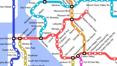
Friday Eye Candy: The World's Subway Systems, If You Could See Them From Above
Have you ever flown over a city and imagined all the subway lines running beneath the surface?
Friday Funny: Imagining Taco Bell-Oriented Rail Transit
A Reddit user created a transit map of the San Francisco Bay Area that connects Taco Bell locations, which, unlike rail public transit, have reached every corner of the region.

Trump Administration Could Effectively End Housing Voucher Program
Federal officials are eyeing major cuts to the Section 8 program that helps millions of low-income households pay rent.

Planetizen Federal Action Tracker
A weekly monitor of how Trump’s orders and actions are impacting planners and planning in America.

Ken Jennings Launches Transit Web Series
The Jeopardy champ wants you to ride public transit.

Washington Legislature Passes Rent Increase Cap
A bill that caps rent increases at 7 percent plus inflation is headed to the governor’s desk.

From Planning to Action: How LA County Is Rethinking Climate Resilience
Chief Sustainability Officer Rita Kampalath outlines the County’s shift from planning to implementation in its climate resilience efforts, emphasizing cross-departmental coordination, updated recovery strategies, and the need for flexible funding.

New Mexico Aging Department Commits to Helping Seniors Age ‘In Place’ and ‘Autonomously’ in New Draft Plan
As New Mexico’s population of seniors continues to grow, the state’s aging department is proposing expanded initiatives to help seniors maintain their autonomy while also supporting family caregivers.
Urban Design for Planners 1: Software Tools
This six-course series explores essential urban design concepts using open source software and equips planners with the tools they need to participate fully in the urban design process.
Planning for Universal Design
Learn the tools for implementing Universal Design in planning regulations.
Heyer Gruel & Associates PA
Ada County Highway District
Institute for Housing and Urban Development Studies (IHS)
City of Grandview
Harvard GSD Executive Education
Toledo-Lucas County Plan Commissions
Salt Lake City
NYU Wagner Graduate School of Public Service