


Friday Eye Candy

Friday Eye Candy: AI Envisions Solutions to the Challenges Facing Cities
Phoenix reimagined for shade. Los Angeles as a place where everybody walks. San Francisco with affordable housing. AI makes a vision of the future possible.
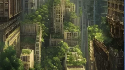
Friday Eye Candy: 20 AI-Generated Cityscapes
AI-generated images are creating new landscapes and cityscapes, capable of inspiring awe or fear.
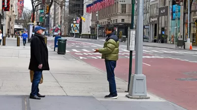
Friday Eye Candy: Covid-19, Then and Now
The New York Times compared images from readers portraying similar scenes in 2020 and 2022.
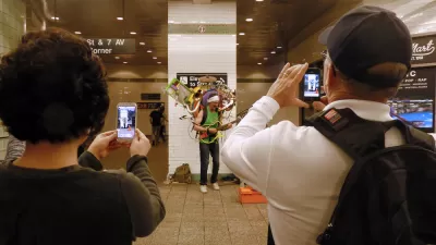
Friday Eye Candy: The Theatricality of the Subway
A new book of photography amplifies what was already there.
Mothballed Rental Car Fleets Fill Stadium Parking Lots
A photo series showcases the disruptive effect the pandemic has had on the U.S. auto industry.
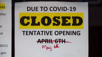
Coronavirus Signs Say So Much
The signs of the times say much more than words can express.
Friday Eye Candy: A Sorely-Needed Map of New York City Neighborhoods
Neighborhoods don't get the same official boundaries as cities, counties, states, and countries. So how do we know where one neighborhood ends and another begins?

The Leaning Tower of Dallas Is Too Good for This World
A failed demolition has created a new, albeit temporary, landmark for Dallas.
Friday Eye Candy: New York City, Minus the Cars and People
Johnny Simon shares the work of artist Marc Yankus, who created a series of images that remove people, cars, and animals from images of New York City.

Friday Eye Candy: A Love Song for Swimming Holes
There's still technically some time left in the summer of 2019 to enjoy a dip, or a frolic, in a swimming hole.
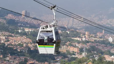
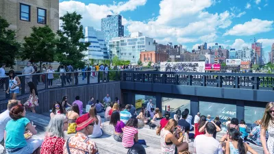
On Public Transit, Some of the World’s Best Sightseeing
From Los Angeles to Hong Kong to Sydney, the best—and the cheapest—views are on ferries, buses, trains, and gondolas.
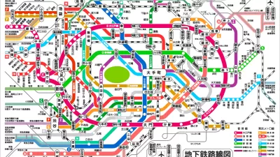
Friday Eye Candy: The World's Subway Systems, If You Could See Them From Above
Have you ever flown over a city and imagined all the subway lines running beneath the surface?

Friday Eye Candy: 195 Gigapixels of Urban Glory
An incredibly detailed bird's eye view of Shanghai.
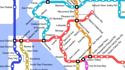
Friday Funny: Imagining Taco Bell-Oriented Rail Transit
A Reddit user created a transit map of the San Francisco Bay Area that connects Taco Bell locations, which, unlike rail public transit, have reached every corner of the region.
Friday Eye Candy: A Cartoon Explains the State of U.S. Public Transit
The Nib unlocks the illustrative and narrative power of cartoons to explain the neglected state of public transit in the Unite States, and to make the case for effective and empowered transit planning.
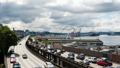
Friday Eye Candy: Painting to Memorialize Seattle's Alaskan Way Viaduct
Finding beauty, and questions, in the concrete.

Friday Eye Candy: Japanese Buildings That Combine 'Oddity and Innovation'
Touring Japan for strange but beautiful buildings.

Friday Eye Candy: Mapping Distance and Social Connectedness
The New York Times published an interactive map that shows how important distance is in determining connections on social media.
Friday Eye Candy: The World's Most Beautiful Cities, Viewed From Above
A collection of drone footage of the world's most beautiful cities, for those of us ready for a deskcation.
Friday Dance Party: Street Ballet a Welcome Change in Congested Mexico City
Witness the "theatricality of public space."
Urban Design for Planners 1: Software Tools
This six-course series explores essential urban design concepts using open source software and equips planners with the tools they need to participate fully in the urban design process.
Planning for Universal Design
Learn the tools for implementing Universal Design in planning regulations.
Ascent Environmental
Borough of Carlisle
Institute for Housing and Urban Development Studies (IHS)
City of Grandview
Harvard GSD Executive Education
Toledo-Lucas County Plan Commissions
Salt Lake City
NYU Wagner Graduate School of Public Service


