


Ok maybe not everything, everything—but the recognizable tropes of subway maps do make it easier to explain everything from the development of cities to musical styles to interstellar scale.
Phil Edwards shares a fun and enlightening list of maps that apply the design tropes of subway maps such as the New York MTA's to everything but the subway. It turns out that the color and spatial coding of subway maps is helpful in providing access to many large and complex subjects.
So for instance, maps of all of the national parks in the United States and the travel routes of the world's largest passenger plan make a lot more sense with the help of subway map-style. Other maps make sense of spatial concepts that might never make sense to mere mortals without the help of subway map-style, such as a map showing the thrust necessary to travel between planets in our solar system, a map of the body's inter-related systems, or a map of the Milky Way Galaxy system—of which, for some perspective, our solar system is only a small stop on a tangential line that leads to the Orion Nebula.
My personal favorite is the map that plots cities as subway stops along the routes provided by North America's rivers.
FULL STORY: 15 subway-style maps that explain everything but subways


Friday Eye Candy: Making Subway Lines Visible From an Airplane
The transit map is useful, but doesn't always capture the scale of the engineering feat that produced the world's subways systems.
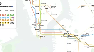
The New New York Subway Map Works in Real Time
There's a new chapter, and maybe an end, for the "Great Subway Map Debate."

Friday Eye Candy: A Sorely-Needed Map of New York City Neighborhoods
Neighborhoods don't get the same official boundaries as cities, counties, states, and countries. So how do we know where one neighborhood ends and another begins?

Alabama: Trump Terminates Settlements for Black Communities Harmed By Raw Sewage
Trump deemed the landmark civil rights agreement “illegal DEI and environmental justice policy.”

Planetizen Federal Action Tracker
A weekly monitor of how Trump’s orders and actions are impacting planners and planning in America.

The 120 Year Old Tiny Home Villages That Sheltered San Francisco’s Earthquake Refugees
More than a century ago, San Francisco mobilized to house thousands of residents displaced by the 1906 earthquake. Could their strategy offer a model for the present?

In Both Crashes and Crime, Public Transportation is Far Safer than Driving
Contrary to popular assumptions, public transportation has far lower crash and crime rates than automobile travel. For safer communities, improve and encourage transit travel.

Report: Zoning Reforms Should Complement Nashville’s Ambitious Transit Plan
Without reform, restrictive zoning codes will limit the impact of the city’s planned transit expansion and could exclude some of the residents who depend on transit the most.

Judge Orders Release of Frozen IRA, IIJA Funding
The decision is a victory for environmental groups who charged that freezing funds for critical infrastructure and disaster response programs caused “real and irreparable harm” to communities.
Urban Design for Planners 1: Software Tools
This six-course series explores essential urban design concepts using open source software and equips planners with the tools they need to participate fully in the urban design process.
Planning for Universal Design
Learn the tools for implementing Universal Design in planning regulations.
Clanton & Associates, Inc.
Jessamine County Fiscal Court
Institute for Housing and Urban Development Studies (IHS)
City of Grandview
Harvard GSD Executive Education
Toledo-Lucas County Plan Commissions
Salt Lake City
NYU Wagner Graduate School of Public Service