


There's a new chapter, and maybe an end, for the "Great Subway Map Debate."
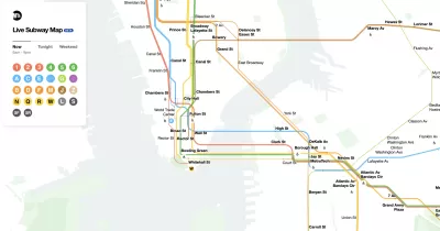
Christopher Bonanos reports: "Today, the MTA is unveiling its new digital map, the first one that uses the agency’s own data streams to update in real time."
After giving a background on the historical precedents for the new map, Bonanos suggests that the map is perhaps the best of both worlds: a combination of the aesthetic accomplishments of the map designed by Massimo Vignelli in the early 1970s, and the more practical, user-focused approach designed by Michael Hertz Associates later the same decade.
"Vignelli’s diagram was a joy to look at and was nearly useless as an aboveground navigation tool. Hertz and Tauranac’s map functioned pretty well as a map to getting around town but inspired comparatively little delight," writes Bonanos to describe the precedent map designs.
The new map, however, is literally contemporary, writes Bonanos:
It’s so thoroughly up-to-the-moment that you can watch individual trains move around the system on your phone. Pinch your fingers on the screen, and you can zoom out to see your whole line or borough, as the lines resolve into single strands. Drag your fingers apart, and you’ll zoom in to see multiple routes in each tunnel springing out, widening into parallel bands — making visible individual service changes, closures and openings, and reroutings. Click on a station, and you can find out whether the elevators and escalators are working.
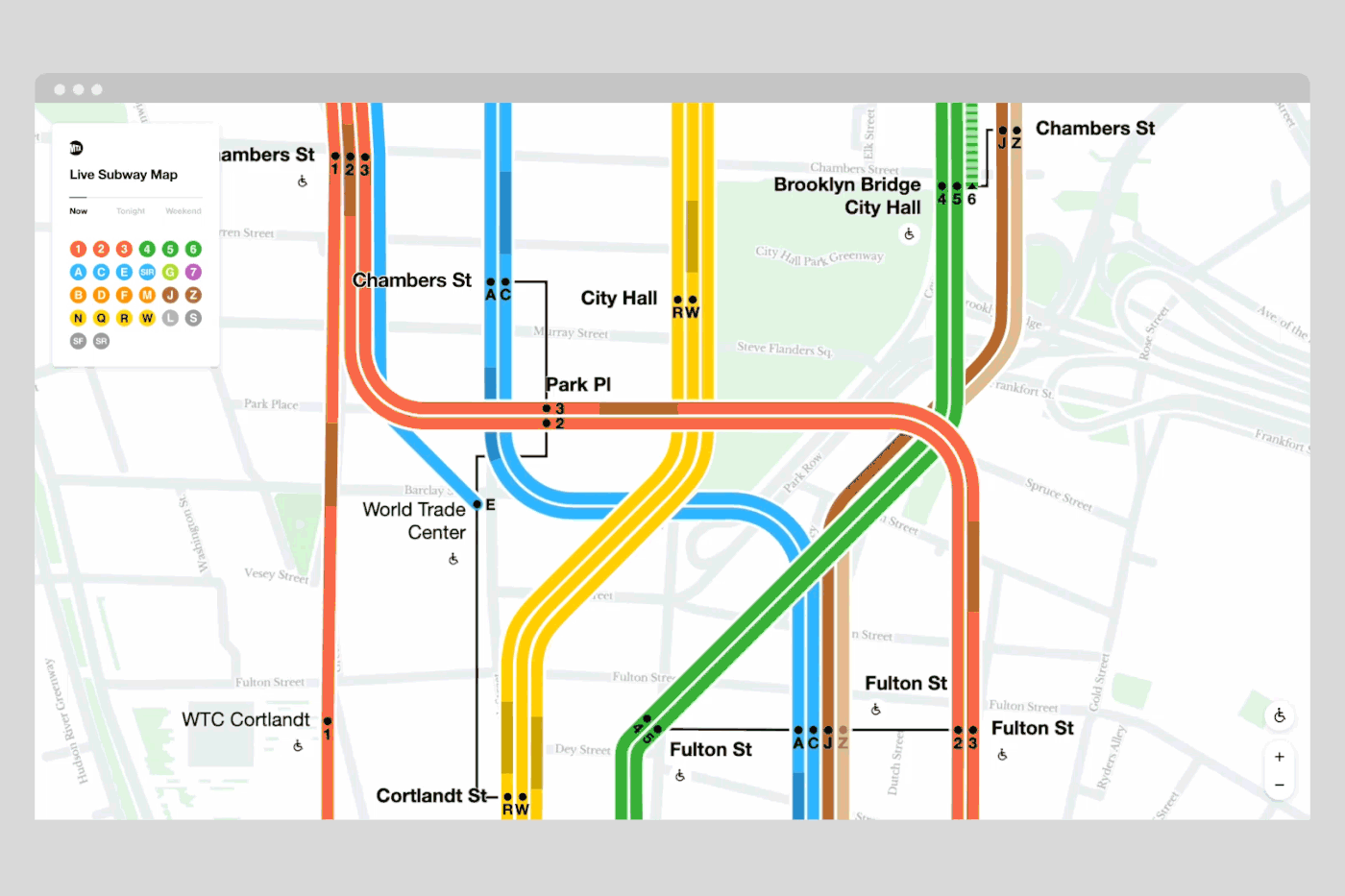
Image courtesy of the Metropolitan Transportation Authority.
The new map is a product of Work & Co, and an expert as august as Michael Beirut has declared the new map to be "legitimately revolutionary," according to Bonanos. The article includes a lot more detail about how the leadership at the New York Metropolitan Transportation Authority kicked off the project and guided the work to its revolutionary completion.
FULL STORY: First Look: New York’s Digital Subway Map Comes Alive Today


Fancy New Subway Cars Join the New York Subway System
New York has been planning on adding these new subway cars for years, finally achieving their goal in March 2023. More than a thousand of the new R211 trains will be running in New York within two years if all goes according to plan.
All-Door Boarding Stuck in Neutral in New York City
MTA leadership has decided all-door boarding will lead to fare evasion and isn’t willing to adopt a program that was already well underway.
New York MTA Seeks New Funding Sources
The agency plans to negotiate new options for operational funding as farebox and toll revenue lingers far below pre-pandemic levels.

Alabama: Trump Terminates Settlements for Black Communities Harmed By Raw Sewage
Trump deemed the landmark civil rights agreement “illegal DEI and environmental justice policy.”

Planetizen Federal Action Tracker
A weekly monitor of how Trump’s orders and actions are impacting planners and planning in America.

The 120 Year Old Tiny Home Villages That Sheltered San Francisco’s Earthquake Refugees
More than a century ago, San Francisco mobilized to house thousands of residents displaced by the 1906 earthquake. Could their strategy offer a model for the present?

Opinion: California’s SB 79 Would Improve Housing Affordability and Transit Access
A proposed bill would legalize transit-oriented development statewide.

Record Temperatures Prompt Push for Environmental Justice Bills
Nevada legislators are proposing laws that would mandate heat mitigation measures to protect residents from the impacts of extreme heat.

Downtown Pittsburgh Set to Gain 1,300 New Housing Units
Pittsburgh’s office buildings, many of which date back to the early 20th century, are prime candidates for conversion to housing.
Urban Design for Planners 1: Software Tools
This six-course series explores essential urban design concepts using open source software and equips planners with the tools they need to participate fully in the urban design process.
Planning for Universal Design
Learn the tools for implementing Universal Design in planning regulations.
Clanton & Associates, Inc.
Jessamine County Fiscal Court
Institute for Housing and Urban Development Studies (IHS)
City of Grandview
Harvard GSD Executive Education
Toledo-Lucas County Plan Commissions
Salt Lake City
NYU Wagner Graduate School of Public Service