


From the years roughly spanning the invention of the automobile to the invention of the smartphone, every driver in Los Angeles traveled with a Thomas Bros. map book. Those days are gone, but nostalgia for physical maps remains.
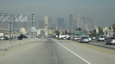
The Thomas Guide used to be the mulit-hundred page key to the city of Los Angeles. Page after page detailed every mile of Los Angeles' freeways, boulevards, streets, and alleys. Almost no one who has lived and driven in the city was without one. They waited patiently on passenger seats, seat back-pockets, floors, and even laps until an unfamiliar address required them to spring into action.
It was a necessary piece of navigating what may be the world's most confusing city. And it gave only so much. The Thomas Guide could tell you what the roads looked like, but it couldn't tell you which ones to take. Not so with GPS, writes Megham Daum in the New York Times Magazine. GPS turns the driver into a passive autopilot. "The city belongs to GPS....driving is less about the big picture than about the next move."
In lamenting, mildy, the demise of the Thomas Guide, Daum longs for the sense of discovery that comes from comparing the real city to the paper city rather than just following the "optimized" route dictated by a computer. And she longs for the intuitive local knowledge that all L.A. drivers eventually develop. Instead, "entire generations are growing up cartographically challenged, if not downright illiterate."
"Out-of-town visitors to Los Angeles like to say things like “driving here is a sport.” But really, it’s an art. It’s an art that requires intuition, patience and a sense of the topography of the region. It means knowing that no matter where you are, there are mountains to the north and an ocean to the west."
FULL STORY: Letter of Recommendation: The Thomas Guide to Los Angeles


Map: The Towers Changing the L.A. Skyline
In Los Angeles, Curbed has declared 2016 "the year of the skyscraper."
Geospatial Technologies for a Healthier, Sustainable, and Increasingly Urban Earth
Penn IUR Co-Directors Genie Birch and Susan Wachter write about the promise of geospatial technologies in promoting sustainable urbanization.
The New L.A. Story: Waze Partners with City; Neighbors Get Upset
A partnership between Waze and the city of Los Angeles has prompted a cry of "not on the street in front of my frontyard!" from residential neighborhoods around the city.

Alabama: Trump Terminates Settlements for Black Communities Harmed By Raw Sewage
Trump deemed the landmark civil rights agreement “illegal DEI and environmental justice policy.”

Planetizen Federal Action Tracker
A weekly monitor of how Trump’s orders and actions are impacting planners and planning in America.

The 120 Year Old Tiny Home Villages That Sheltered San Francisco’s Earthquake Refugees
More than a century ago, San Francisco mobilized to house thousands of residents displaced by the 1906 earthquake. Could their strategy offer a model for the present?

Indy Neighborhood Group Builds Temporary Multi-Use Path
Community members, aided in part by funding from the city, repurposed a vehicle lane to create a protected bike and pedestrian path for the summer season.

Congestion Pricing Drops Holland Tunnel Delays by 65 Percent
New York City’s contentious tolling program has yielded improved traffic and roughly $100 million in revenue for the MTA.

In Both Crashes and Crime, Public Transportation is Far Safer than Driving
Contrary to popular assumptions, public transportation has far lower crash and crime rates than automobile travel. For safer communities, improve and encourage transit travel.
Urban Design for Planners 1: Software Tools
This six-course series explores essential urban design concepts using open source software and equips planners with the tools they need to participate fully in the urban design process.
Planning for Universal Design
Learn the tools for implementing Universal Design in planning regulations.
Clanton & Associates, Inc.
Jessamine County Fiscal Court
Institute for Housing and Urban Development Studies (IHS)
City of Grandview
Harvard GSD Executive Education
Toledo-Lucas County Plan Commissions
Salt Lake City
NYU Wagner Graduate School of Public Service