


Maps
Friday Ear Candy: Mapping the Sound of the City
Chatty Maps break down the sound profile of cities.
Visualizing Parking in the City of Brotherly Love: Parkadelphia
An intrepid city employee created Philadelphia's first mapping tool for visualizing the layers of regulation and management that govern when, when, and how people park in Philadelphia.
Facebook Is Mapping the World's Buildings
A mapping project lead by Facebook's Connectivity Lab is gathering data from all over the atmosphere, and beyond, to make a comprehensive map of the world's buildings.
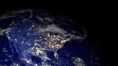
Mapping the Trends in Pollution
Good news for the United States is found in a recent series of maps by NASA. Air pollution has significantly improved around the country.
Mapping Ten Years of Affordable Housing Projects in Chicago
The power of open data and mapping is on display in a map by Chicago Cityscape that shows all building permits for affordable housing in Chicago over the past decade.

Friday Eye Candy: Mapping the Least Dense Places in the U.S.
A map-making effort by The Washington Post's Wonkblog puts the Western United States' population, or lack thereof, in perspective.
Mapping the U.S. 'Turkey Belt'
Don't worry; we're not mentioning belts to make you feel too guilty to enjoy today's meal.

Mapping the End of Parking Minimums
The high cost of free parking is almost, but not quite, common knowledge. Many, but not all, people realize the pernicious effects of parking requirements. A map can help illustrate this spreading awareness.

Friday Eye Candy: A New Cultural Atlas of Portland
"Portlandness: A Cultural Atlas" exemplifies the powers of maps to reshape and redefine our communities. Just watch how they can change expectations about the culture of the city infamously known as "Portlandia."
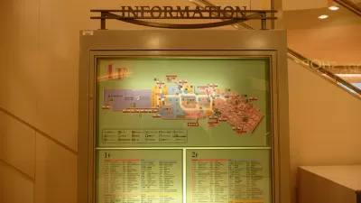
The Future of Mapping is Going Indoors
Cartographers have a new world to map, as technology opens up the interiors of malls, museums, and other large spaces to online exploration.
Mapping U.S. Road Fatalities from 2003-2014
An intrepid mapmaker and data cruncher has created a map that illustrates the ubiquity of fatalities on U.S. roads and highways.
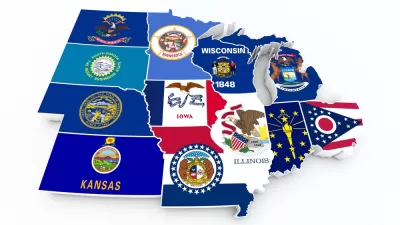
12 Maps to Explain the Midwest
Aaron Renn scours the Internet to find 12 maps that attempt to do the impossible: define the geographic and cultural expanse known as the American Midwest.
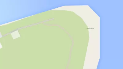
Friday Funny: The Instagram Account of Saddest Place Names Is Actually Kind of Sad
Did you know there's a place called Point No Point, in Hansville, Washington? It's quite pretty, actually, but is that reason enough to go there?
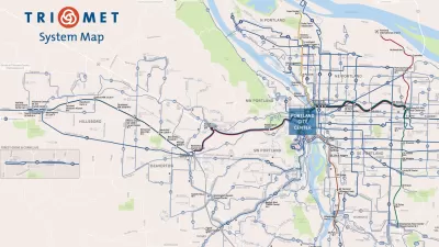
How to Design a Better Bus Transit Map
Not all transit maps are created equal. The new Portland TriMet map, for instance, does a much better job of illustrating the usefulness of its high-frequency network.

A Real-Time Map of Global Air Pollution
A quick look at a real-time map of air pollution around the world shows how much healthier the air in the United States is than in China.
How to Build a Real-Time LED Display of Your City's Transit System
One MIT student's love of transit means no one in his house will ever miss the T.
'ManyCities' Uses Mobile Phone Data to Visualize Human Activity
A new online visualization tool makes it easier to read and understand data about mobile phone usage in four cities around the world, including Los Angeles and New York.
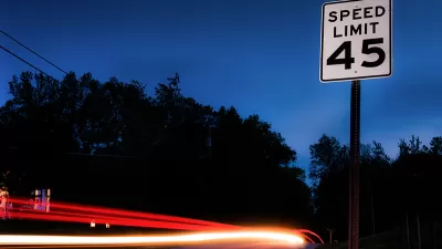
America's Speed Limits Visualized
America's quilt of speed limits now reaches 85 MPH in some states, with increases possible in some western states. MetricMaps has produced a visualization of the top speed limits across the country and even in detail in urban areas.

Mapping the Country's 38 Million Epic Commutes
The Wonkblog team puts new American Community Survey data to good use.

Mapping (and Ranking) the Natural Amenities of U.S. Counties
Wonkblog illustrates the results of a "Natural Amenities Index" created by the federal government.
Urban Design for Planners 1: Software Tools
This six-course series explores essential urban design concepts using open source software and equips planners with the tools they need to participate fully in the urban design process.
Planning for Universal Design
Learn the tools for implementing Universal Design in planning regulations.
Heyer Gruel & Associates PA
Ada County Highway District
Institute for Housing and Urban Development Studies (IHS)
City of Grandview
Harvard GSD Executive Education
Toledo-Lucas County Plan Commissions
Salt Lake City
NYU Wagner Graduate School of Public Service


