


Aaron Renn scours the Internet to find 12 maps that attempt to do the impossible: define the geographic and cultural expanse known as the American Midwest.
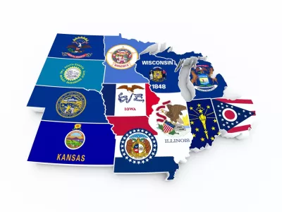
A listicle by Aaron Renn surveys the many different approaches to mapping the Midwest.
The list includes a traditional map, as defined in the early days of the United States, to the bureaucratic definition set forth but the U.S. Census Bureau. Other maps locate the Midwest in relation to the other "nations" in the United States and some break down the larger area of the Midwest into smaller sub-regions, such as the "Lower Lakes," the "North Woods," and the "Plains." Showing off the capabilities of the Internet, online survey mechanisms and the crowdsourcing power of Reddit have also helped a few intrepid social commentators create their own maps. Finally, other data collection methods have helped compile patterns out of the self-selecting behavior of Midwesterners.
FULL STORY: 12 Ways to Map the Midwest

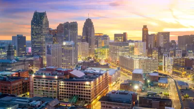
Detroit and Michigan on the Upswing
It's been 66 years since the Motor City last grew its population. Census data released last month revealed an increase of nearly 2,000 people last year, nearly half the state's population growth.

The 15 Fastest-Growing Cities in the US
The U.S. Census Bureau released new 2023 population estimates on May 16 showing a slew of data for cities of all sizes and regions. Do you know the population change last year for the 15 largest cities in your state?

Maps: How Much of Your City is Parking?
The percentage of land dedicated to parking in the central districts of major U.S. cities ranges from 4 percent to as much as 42 percent.

Alabama: Trump Terminates Settlements for Black Communities Harmed By Raw Sewage
Trump deemed the landmark civil rights agreement “illegal DEI and environmental justice policy.”

Study: Maui’s Plan to Convert Vacation Rentals to Long-Term Housing Could Cause Nearly $1 Billion Economic Loss
The plan would reduce visitor accommodation by 25% resulting in 1,900 jobs lost.

Why Should We Subsidize Public Transportation?
Many public transit agencies face financial stress due to rising costs, declining fare revenue, and declining subsidies. Transit advocates must provide a strong business case for increasing public transit funding.

Paris Bike Boom Leads to Steep Drop in Air Pollution
The French city’s air quality has improved dramatically in the past 20 years, coinciding with a growth in cycling.

Why Housing Costs More to Build in California Than in Texas
Hard costs like labor and materials combined with ‘soft’ costs such as permitting make building in the San Francisco Bay Area almost three times as costly as in Texas cities.

San Diego County Sees a Rise in Urban Coyotes
San Diego County experiences a rise in urban coyotes, as sightings become prevalent throughout its urban neighbourhoods and surrounding areas.
Urban Design for Planners 1: Software Tools
This six-course series explores essential urban design concepts using open source software and equips planners with the tools they need to participate fully in the urban design process.
Planning for Universal Design
Learn the tools for implementing Universal Design in planning regulations.
Smith Gee Studio
Alamo Area Metropolitan Planning Organization
City of Santa Clarita
Institute for Housing and Urban Development Studies (IHS)
City of Grandview
Harvard GSD Executive Education
Toledo-Lucas County Plan Commissions
Salt Lake City
NYU Wagner Graduate School of Public Service