


America's quilt of speed limits now reaches 85 MPH in some states, with increases possible in some western states. MetricMaps has produced a visualization of the top speed limits across the country and even in detail in urban areas.
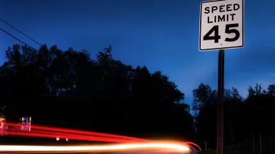
The middle swath of the United States may be considered Red States, but on MetricMaps' new visualization of nationwide speed limits, the states of the Great Plains and Rocky Mountains are a deep blue. It turns out that places that lean libertarian don't much like to place limits on drivers. Today, freedom means a speed limit of 80 MPH in many places, meaning that actual speeds are likely to be much higher.
"The Missouri River, as it turns out, is a kind of speed-limit fault line: Most states west of it consider legal what Virginia, Ohio and Illinois would call 'speeding.'"
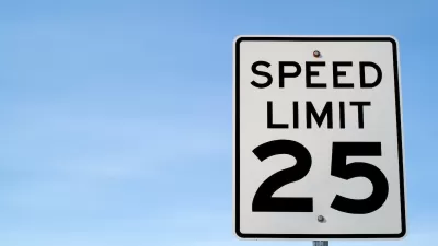
MetricMaps has made visualizations of individual cities, displaying road networks according to their speed limits. Large areas of local streets that might be limited to 30 MPH are punctuated by arterial roads and freeways. Neutral as they are, the maps leave it to urban planners to decide how these speeds impact quality of life and safety for pedestrians and drivers alike.
"These maps, through the lens of speed limits, reflect the hierarchy of how we build roads, from local residential streets, to busier boulevards, to limited-access arterials and high-speed highways. Each environment demands different standards. But this national map also raises a question central to"vision zero" campaigns trying to end pedestrian deaths and make roads safer: Does it make sense that a residential neighborhood in Houston would allow faster traffic than a residential neighborhood in Brooklyn?"
FULL STORY: Where ‘speeding’ is legal: A map of maximum limits across the U.S.


A Map of Worldwide Speed Limits
Do you have a need for speed? Or at least a need to know the speed limit anywhere in the world? Greater Greater Washington has just the map for you.
Santa Monica Lowers Speed Limits
Posted speed limits will be reduced by 5 miles per hour on dozens of the city’s streets.

Reducing Driving Speeds Requires More Than Lowering Posted Speed Limits
Without additional changes to roadway design, lower speed limits only slightly reduce driving speeds.

Alabama: Trump Terminates Settlements for Black Communities Harmed By Raw Sewage
Trump deemed the landmark civil rights agreement “illegal DEI and environmental justice policy.”

Planetizen Federal Action Tracker
A weekly monitor of how Trump’s orders and actions are impacting planners and planning in America.

The 120 Year Old Tiny Home Villages That Sheltered San Francisco’s Earthquake Refugees
More than a century ago, San Francisco mobilized to house thousands of residents displaced by the 1906 earthquake. Could their strategy offer a model for the present?

In Both Crashes and Crime, Public Transportation is Far Safer than Driving
Contrary to popular assumptions, public transportation has far lower crash and crime rates than automobile travel. For safer communities, improve and encourage transit travel.

Report: Zoning Reforms Should Complement Nashville’s Ambitious Transit Plan
Without reform, restrictive zoning codes will limit the impact of the city’s planned transit expansion and could exclude some of the residents who depend on transit the most.

Judge Orders Release of Frozen IRA, IIJA Funding
The decision is a victory for environmental groups who charged that freezing funds for critical infrastructure and disaster response programs caused “real and irreparable harm” to communities.
Urban Design for Planners 1: Software Tools
This six-course series explores essential urban design concepts using open source software and equips planners with the tools they need to participate fully in the urban design process.
Planning for Universal Design
Learn the tools for implementing Universal Design in planning regulations.
Clanton & Associates, Inc.
Jessamine County Fiscal Court
Institute for Housing and Urban Development Studies (IHS)
City of Grandview
Harvard GSD Executive Education
Toledo-Lucas County Plan Commissions
Salt Lake City
NYU Wagner Graduate School of Public Service