


Maps

Friday Eye Candy: Charting Road Maps By Hand
In the days before Google Maps, when AAA TripTiks and Thomas Guides ruled the planet…
Mapping All the Transit Corridors Targeted for Upzoning Under California's SB 827
SB 827, announced last week by California State Senator Scott Wiener, would revoke density maximums, parking minimums, and set permissive height limits along transit corridors all over the state.

Mapzen to Close at the End of January
The mapping community was sad to learn this week that the Mapzen open source mapping platform would cease operation at the end of the month. Many of Mapzen's open source tools will live on, for those that now how to use them.

A New Way to Explore Local Transit Ridership Data
TransitCenter has released a new National Ridership Map.
Mapping the Country's Debt
An interactive map from the Urban Institute invites comparisons in the geography of debt.

What One Oil Pipeline Spill Every Day Looks Like on a Map
The recent spill of 210,000 gallons of crude oil from the Keystone pipeline in South Dakota was far from an outlier.
Friday Eye Candy: Highly Detailed Cold War Era Soviet Maps of the U.S.
A new book sheds light on maps created by cartographers in the Soviet Union that dove into remarkable detail about buildings, transportation networks, and other infrastructure in cities across the United States and around the world.

Like Waze, But for Bikes
The mobile app LaneSpotter, described as a navigation app like Waze but for cyclists, has announced eight cities as the location for a pilot launch.

'Housing Insights' Mapping Tool Designed to Preserve Subsidized Housing in D.C.
The Housing Insights team of volunteer civic hackers hopes you'll use their software in other cities, too.

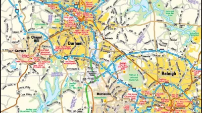
Take an Online Tour of Historic Prince George's County, Maryland
You don't have to be a fan of Prince George's County to be a fan of the historical maps and geographic insight on the online Prince George's Atlas.

Redesign D.C.'s Metro With an Interactive Mapping Tool
Metro Map Maker allows users to add, alter, and erase pieces of the WMATA system—or redraw it from scratch.
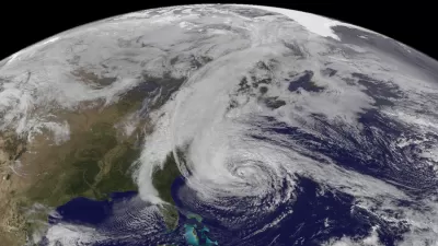
Mapping the Paths of Hurricanes Recorded Since 1851
All yesterday's hurricanes.

Watch Transit Move With These Animated Maps
The variables in public transit service have never been so brightly and kinetically illustrated.
Seattle's Weirdest Intersections Make a Fetching Design
One artist capitalized on the quirks of Seattle's street grid.

Friday Eye Candy: Mapping the Nation's Internet Trolls
Finally, we know where Internet trolls come from—no, not the basements of parents' houses.

Metrorail Travel Patterns Revealed
Commute data for one of the nation's premier rail transit systems, revealed.

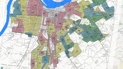
Pittsburgh Takes Property Data Visualization to the Next Level
Not all property data maps are created equal.
No Self-Driving Cars Without Hyper-Local Maps
While the fame and the glory might go to the first companies that bring self-driving cars to the market, the companies that provide the detailed, constantly changing maps will make a lot of money.
Mapping the Tools of Discrimination
The Innovations in Government Program at the Harvard Kennedy School’s Ash Center for Democratic Governance and Innovation has announced the first winner of the "Map of the Month" contest.

Friday Eye Candy: Ancient Rome's Maps, Reimagined as a Transit System
There are surprisingly few maps of ancient Roman roads, and many fewer maps of ancient Roman roads that resemble big-city subway maps. An intrepid student has improved upon that situation, however.
Urban Design for Planners 1: Software Tools
This six-course series explores essential urban design concepts using open source software and equips planners with the tools they need to participate fully in the urban design process.
Planning for Universal Design
Learn the tools for implementing Universal Design in planning regulations.
Heyer Gruel & Associates PA
Ada County Highway District
Institute for Housing and Urban Development Studies (IHS)
City of Grandview
Harvard GSD Executive Education
Toledo-Lucas County Plan Commissions
Salt Lake City
NYU Wagner Graduate School of Public Service


