


The variables in public transit service have never been so brightly and kinetically illustrated.
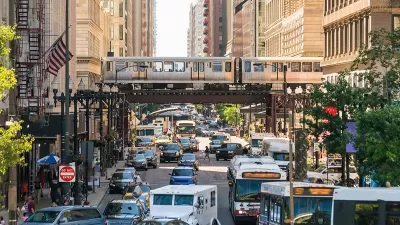
Will Geary explains the thinking behind, TransitFlow, "an experimental set of tools to generate spatial-temporal transit frequency datasets and visualizations from the command line."
That is, TransitFlow allows the creation of animated maps showing the movement of public transit modes around cities and regions. The TransitFlow team created the tool to help illustrate the importance of frequency, among other critical aspects of transit service.
See below for examples of the San Francisco Bay Area, New York City, Amtrak trips around the United States, and Mexico City.
There are a lot more examples from around the United States and the world available on Geary's Vimeo portfolio.
FULL STORY: TransitFlow — using Python and Processing to visualize regional transit frequency


A New Way to Explore Local Transit Ridership Data
TransitCenter has released a new National Ridership Map.

Mapping Climate Impact at the Neighborhood Level
A consumption-based analysis illustrates the differences in average household emissions across census tracts.
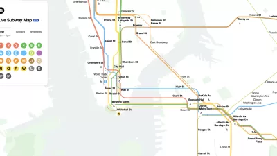
The New New York Subway Map Works in Real Time
There's a new chapter, and maybe an end, for the "Great Subway Map Debate."

Alabama: Trump Terminates Settlements for Black Communities Harmed By Raw Sewage
Trump deemed the landmark civil rights agreement “illegal DEI and environmental justice policy.”

Planetizen Federal Action Tracker
A weekly monitor of how Trump’s orders and actions are impacting planners and planning in America.

The 120 Year Old Tiny Home Villages That Sheltered San Francisco’s Earthquake Refugees
More than a century ago, San Francisco mobilized to house thousands of residents displaced by the 1906 earthquake. Could their strategy offer a model for the present?

Ken Jennings Launches Transit Web Series
The Jeopardy champ wants you to ride public transit.

BLM To Rescind Public Lands Rule
The change will downgrade conservation, once again putting federal land at risk for mining and other extractive uses.

Indy Neighborhood Group Builds Temporary Multi-Use Path
Community members, aided in part by funding from the city, repurposed a vehicle lane to create a protected bike and pedestrian path for the summer season.
Urban Design for Planners 1: Software Tools
This six-course series explores essential urban design concepts using open source software and equips planners with the tools they need to participate fully in the urban design process.
Planning for Universal Design
Learn the tools for implementing Universal Design in planning regulations.
Clanton & Associates, Inc.
Jessamine County Fiscal Court
Institute for Housing and Urban Development Studies (IHS)
City of Grandview
Harvard GSD Executive Education
Toledo-Lucas County Plan Commissions
Salt Lake City
NYU Wagner Graduate School of Public Service