


Cartography
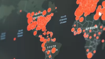
Visualizing the Coronavirus Pandemic
Mapping of the crisis is producing a fascinating and important trove of cartographic records.

Friday Funny: Cartographers Are Hiding an Idyllic Continent
The rest of the world would only spoil it for the mapmakers.
Friday Eye Candy: Highly Detailed Cold War Era Soviet Maps of the U.S.
A new book sheds light on maps created by cartographers in the Soviet Union that dove into remarkable detail about buildings, transportation networks, and other infrastructure in cities across the United States and around the world.

Friday Eye Candy: The Childhood Maps of 8 Professional Mapmakers
Choosing cartography as a career is a natural result of a lifelong love of maps. National Geographic gathers the proof.
Changes to Google Maps Don't Necessarily Equal Good Cartography
Google Maps has changed a lot since its quick rise to ubiquity. An intrepid blogger digs into the nitty gritty of how the mapping platform has changed, and the consequences of Google's cartography for how the public perceives the world.
Four New Map Books Reviewed
Looking for the perfect holiday gift for a planner? Check out these new map books.
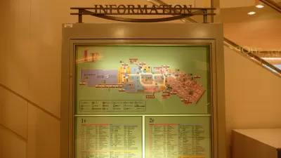
The Future of Mapping is Going Indoors
Cartographers have a new world to map, as technology opens up the interiors of malls, museums, and other large spaces to online exploration.

Today's Cartographers Are Database Engineers
Modern maps are visual representations of millions of points of standardized data.
Friday Eye Candy: Full-Color, HD Videos Taken from Space
For the first time, full-color videos of the earth's surface will be made available to the public, with added options for paying customers. The imagery comes from two cameras on the International Space Station.

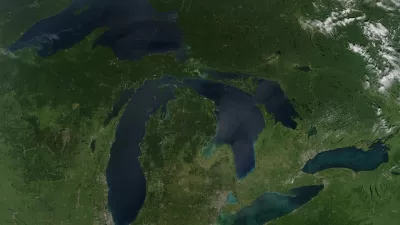
China Submerged: Mapping Nightmare Sea Levels
Cartographer Jeffrey Linn has compiled maps of how coastal China would look under risen seas. Over 40 percent of the country's population lives in potentially affected regions.
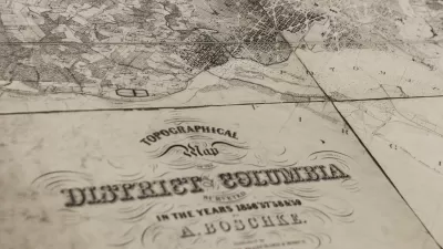
USGS Map Archive Now Easily Accessible
The U.S. Geological Survey has introduced topoView, an intuitive map-based tool making it far simpler to search and access its archive of 178,000 topographical maps dating from 1880 to 2010.
Friday Eye Candy: SPUR's Urban Cartography Exhibit
Allison Arieff provides a glimpse to the San Francisco Planning and Urban Research's new exhibit featuring interesting maps of the San Francisco Bay Area.
Friday Eye Candy: USGS Launches Historical Topographic Map Explorer
A new tool, released in partnership with the U.S. Geological Survey and Esri, provides easy access to historical maps from all over the country, featuring a timeline to easily select maps from different eras.
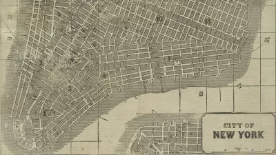
Friday Eye Candy: New York Public Library Releases Thousands of Historic Maps to the Public
“For the historic cartographile, Christmas may have come late, but here it is,” writes Daniel Stuckey.

World's Oldest New World Globe Found on an Ostrich Egg
A collector has discovered the world's oldest globe to depict the New World, which may have originated from Leonardo da Vinci's shop in 1504.
How Has 'Mapping' Changed How We Communicate Ideas About Buildings and Landscapes?
Cartographic Grounds, a recent exhibition at the Harvard Graduate School of Design — now online at Places — seeks to "reconcile the precision and instrumentality of the plan with the geographic and territorial scope of the map."
A New Tool for Those Searching for a Similar Sense of Place
A new program developed by University of Cincinnati Professor Tomasz Stepinski allows users to find sections of the American landscape with similar land coverage or ecological patterns.
Who Defines New York's Nabes? For Starters Look to These Amateur Mapmakers
In New York, neighborhood boundaries are big business. Just ask any real estate agent who's tried to pass off a Gowanus apartment as being in Park Slope. Since the city does not officially define boundaries, amateurs are filling the void.
Innovative Map Shows Estimated Time of Arrival for Entire Regions
Want to know how long it will take to pick up the kids at school, drive to your favorite restaurant, drive the baseball game, take the bus to the park? And all at once? Trulia's new innovative map does just that.
Owning up to NYC's Subway Map Mistakes
Matt Flegenheimer reports on how newly found errors in New York's vaunted subway map have reignited a battle over who deserves credit for its design, and who should own up to its mistakes.
Urban Design for Planners 1: Software Tools
This six-course series explores essential urban design concepts using open source software and equips planners with the tools they need to participate fully in the urban design process.
Planning for Universal Design
Learn the tools for implementing Universal Design in planning regulations.
Caltrans
Smith Gee Studio
Institute for Housing and Urban Development Studies (IHS)
City of Grandview
Harvard GSD Executive Education
Toledo-Lucas County Plan Commissions
Salt Lake City
NYU Wagner Graduate School of Public Service


