


Cartographic Grounds, a recent exhibition at the Harvard Graduate School of Design — now online at Places — seeks to "reconcile the precision and instrumentality of the plan with the geographic and territorial scope of the map."
"The ascendance of 'mapping' and data visualization in design culture has changed the way architects, landscape architects and urban designers communicate ideas about buildings and landscapes, often privileging abstract forces and flows over the material conditions of the site," writes curator Jill Desimini. "We have an even greater challenge now, as our drawings are required to be interactive, to make sense of big data, and to describe increasingly complex systems."
"As design extends its purview to cartography, it is time once again to look closely at maps and plans, to immerse ourselves in their beauty but also to uncover their projective potential."
Desimini explores a range of cartographic practices, from a 13th-century view of the British Isles to contemporary data visualization.
FULL STORY: Cartographic Grounds: Projecting the Landscape Imaginary

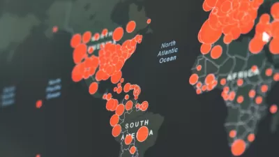
Visualizing the Coronavirus Pandemic
Mapping of the crisis is producing a fascinating and important trove of cartographic records.

Friday Eye Candy: Full-Color, HD Videos Taken from Space
For the first time, full-color videos of the earth's surface will be made available to the public, with added options for paying customers. The imagery comes from two cameras on the International Space Station.

China Submerged: Mapping Nightmare Sea Levels
Cartographer Jeffrey Linn has compiled maps of how coastal China would look under risen seas. Over 40 percent of the country's population lives in potentially affected regions.

Alabama: Trump Terminates Settlements for Black Communities Harmed By Raw Sewage
Trump deemed the landmark civil rights agreement “illegal DEI and environmental justice policy.”

Study: Maui’s Plan to Convert Vacation Rentals to Long-Term Housing Could Cause Nearly $1 Billion Economic Loss
The plan would reduce visitor accommodation by 25% resulting in 1,900 jobs lost.

Planetizen Federal Action Tracker
A weekly monitor of how Trump’s orders and actions are impacting planners and planning in America.

Wind Energy on the Rise Despite Federal Policy Reversal
The Trump administration is revoking federal support for renewable energy, but demand for new projects continues unabated.

Passengers Flock to Caltrain After Electrification
The new electric trains are running faster and more reliably, leading to strong ridership growth on the Bay Area rail system.

Texas Churches Rally Behind ‘Yes in God’s Back Yard’ Legislation
Religious leaders want the state to reduce zoning regulations to streamline leasing church-owned land to housing developers.
Urban Design for Planners 1: Software Tools
This six-course series explores essential urban design concepts using open source software and equips planners with the tools they need to participate fully in the urban design process.
Planning for Universal Design
Learn the tools for implementing Universal Design in planning regulations.
Caltrans
Smith Gee Studio
Institute for Housing and Urban Development Studies (IHS)
City of Grandview
Harvard GSD Executive Education
Toledo-Lucas County Plan Commissions
Salt Lake City
NYU Wagner Graduate School of Public Service