


Mapping

New Book Shows How Geographic Technology Tackles Global Challenges
In his new book, Jack Dangermond explores the transformative impact of GIS technology in solving global challenges through spatial data, highlighting its widespread application across sectors and its potential to design sustainable futures.

Building Healthier Communities: The Role of GIS in Park Planning
Integrating Geographic Information Systems (GIS) into park planning enhances community health by promoting physical activity, supporting mental well-being, fostering social connectedness, and addressing public health crises and climate change.
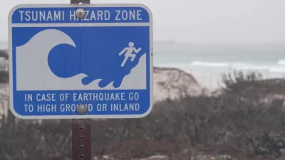
Washington State Requests Federal Funding for Tsunami Preparedness
The state’s Department of Natural Resources says it needs continued funding to map coastal areas at risk for tsunami impacts and prepare mitigation and evacuation plans.
New Book Highlights How GIS Improves Outcomes
Esri Press recently published a digital book called Mapping the Nation which demonstrates how a geographic approach guides important decisions and addresses challenges around the globe.

Map Identifies DeKalb County Brownfield Sites
The GIS tool is designed to help developers find vacant and blighted lots that could be restored for new housing or other uses.
The Growing Importance of Location Intelligence
Location intelligence is transforming decision-making, with an increasing number and type of organizations modernizing operations with a geographic approach to problem-solving, planning, and prediction.

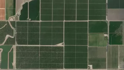
What Is GIS?
GIS software, which combines location information with data about a range of other attributes, has become an indispensable tool for mapping and spatial analysis in urban planning and dozens of other fields.

Mapping Heat Inequality
A new mapping tool underscores inequities in infrastructure that lead to higher rates of heat-related illnesses in low-income neighborhoods.
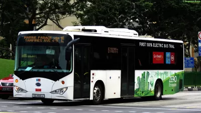
What’s the Fairest Way to Deploy Electric Buses? Ask This Open-Source Map
While the deployment of electric buses can help mitigate the air quality impacts of public transportation, transit authorities often face budgeting constraints that center cost reduction rather than equity—until now.

Mapping Informal Neighborhoods
New mapping tools are helping cities around the world map and understand their poorest communities.

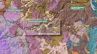
How the National Park Service Uses GIS
A new book demonstrates how the National Park Service uses GIS technology to meet its mission and showcases a selection of maps used for effectively managing national parks.

New Tool Aims to Make Parks More Resilient to Climate Change
The interactive mapping platform helps park managers understand the risks in their area and create long-term resilience plans.
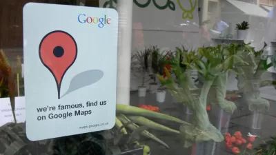
Meet Google's Open Source, Time-Traveling Map
All historic maps are welcome in Google's open source machine learning project.
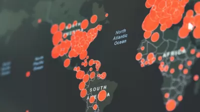
Visualizing the Coronavirus Pandemic
Mapping of the crisis is producing a fascinating and important trove of cartographic records.

Esri Sets Up COVID-19 GIS Hub
The planning profession can contribute to the worldwide fight to control the spread of COVID-19. GIS technology, for instance, allows real-time monitoring of the pandemic.
Real-Time Art Installation Reveals the Many Dimensions of Data
Using a wagon filled with phones, an artist in Berlin demonstrated the disconnect between data and the real world.

Mapping Housing Discrimination in Charlottesville
Like many American cities, the site of white supremacist unrest in 2017 has a long history of residential discrimination by race. This mapping project seeks to uncover the roots of today's disparities.
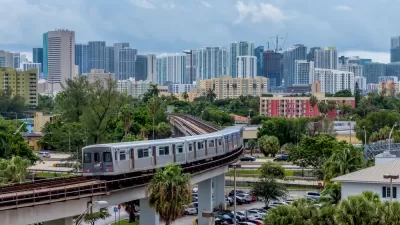
New Tool Puts Miami Development Opportunities on the Map
There's plenty of vacant or underutilized land to be found in Miami-Dade County, if you know where and how to look.
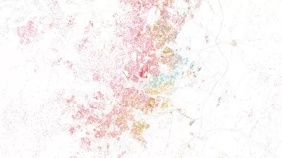
Facebook AI Maps Population Density
Facebook expects to release its worldwide maps of human density in the coming months—potential applications will likely be somewhere on the spectrum between humanitarian and commercial.
Esri App Makes Data Visualization Easy
A wealth of pre-authored policy maps lets users access data to explore public policy issues.
Urban Design for Planners 1: Software Tools
This six-course series explores essential urban design concepts using open source software and equips planners with the tools they need to participate fully in the urban design process.
Planning for Universal Design
Learn the tools for implementing Universal Design in planning regulations.
Heyer Gruel & Associates PA
Ada County Highway District
Institute for Housing and Urban Development Studies (IHS)
City of Grandview
Harvard GSD Executive Education
Toledo-Lucas County Plan Commissions
Salt Lake City
NYU Wagner Graduate School of Public Service


