


New mapping tools are helping cities around the world map and understand their poorest communities.
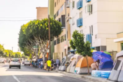
"The geography of slum living has long been poorly defined," writes Laura Bliss, but an international NGO hopes to change that by facilitating the mapping of informal neighborhoods in cities around the world. According to Tony Frangie, "It’s no secret that census officials don’t really go deep into these areas, so nobody really knows the real population of the entire city." And "[w]ith no street names or buildings on platforms such as Google Maps, information gaps keep much of the slum landscape hidden to outsiders. For residents, it makes it harder to access the benefits and services of urban development, such as roads, water hookups, sanitation and the internet. "
The ability to create maps of formerly ignored areas can have immediate impacts on people's access to services. Map Kibera, a project in Kenya, "has shown by providing geographic information to NGOs and activists that have successfully improved water connections and the number of schools in slums outside Nairobi."
"In Caracas, a group of researchers and students recorded the streets and businesses of the San Miguel de la Vega slum using notebooks and smartphones, then uploaded the information to OpenStreetMap, the open-source mapping platform" to create a map of the neighborhood. "Humanitarian OpenStreetMap Team (HOT), an international NGO dedicated to open-source mapping for development and humanitarian purposes, has helped dozens of similar projects around the world."
FULL STORY: MapLab: Putting Slums on the Map

Mapping Needed to Improve Slums
Understanding and improving the Brazilian informal settlements known as favelas will require more information about the slums -- especially in the field of mapping.

New Book Shows How Geographic Technology Tackles Global Challenges
In his new book, Jack Dangermond explores the transformative impact of GIS technology in solving global challenges through spatial data, highlighting its widespread application across sectors and its potential to design sustainable futures.

Building Healthier Communities: The Role of GIS in Park Planning
Integrating Geographic Information Systems (GIS) into park planning enhances community health by promoting physical activity, supporting mental well-being, fostering social connectedness, and addressing public health crises and climate change.

Alabama: Trump Terminates Settlements for Black Communities Harmed By Raw Sewage
Trump deemed the landmark civil rights agreement “illegal DEI and environmental justice policy.”

Study: Maui’s Plan to Convert Vacation Rentals to Long-Term Housing Could Cause Nearly $1 Billion Economic Loss
The plan would reduce visitor accommodation by 25% resulting in 1,900 jobs lost.

Planetizen Federal Action Tracker
A weekly monitor of how Trump’s orders and actions are impacting planners and planning in America.

Wind Energy on the Rise Despite Federal Policy Reversal
The Trump administration is revoking federal support for renewable energy, but demand for new projects continues unabated.

Passengers Flock to Caltrain After Electrification
The new electric trains are running faster and more reliably, leading to strong ridership growth on the Bay Area rail system.

Texas Churches Rally Behind ‘Yes in God’s Back Yard’ Legislation
Religious leaders want the state to reduce zoning regulations to streamline leasing church-owned land to housing developers.
Urban Design for Planners 1: Software Tools
This six-course series explores essential urban design concepts using open source software and equips planners with the tools they need to participate fully in the urban design process.
Planning for Universal Design
Learn the tools for implementing Universal Design in planning regulations.
Caltrans
Smith Gee Studio
Institute for Housing and Urban Development Studies (IHS)
City of Grandview
Harvard GSD Executive Education
Toledo-Lucas County Plan Commissions
Salt Lake City
NYU Wagner Graduate School of Public Service