


A wealth of pre-authored policy maps lets users access data to explore public policy issues.
The Esri Maps for Public Policy app allows users to quickly and easily put together maps by customizing existing Esri maps. "The app gives users ready-to-use location intelligence and express access to policy maps, so they can skip the steps of obtaining and preparing the data," writes Karisa Schroeder.
The app maps are based on the ArcGIS Living Atlas of the World collection of data, which is constantly updated. Esri Maps for Public Policy users select a location at the local, state, or national level and a topic and then have the option to add data from any of 400 available maps.
"The app includes data on social equity and health, economic opportunity, transportation and infrastructure, resilience and sustainability, the environment and natural resources, and public safety," notes Schroder. Esri is encouraging policymakers and citizens to use the app to help them as they face challenges in their communities around issues such as public health, affordable housing, and mobility.
FULL STORY: Mapping for Community Impact


Esri Sets Up COVID-19 GIS Hub
The planning profession can contribute to the worldwide fight to control the spread of COVID-19. GIS technology, for instance, allows real-time monitoring of the pandemic.

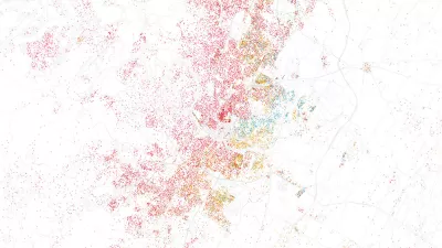
Mapping All the Land Uses in the Lower 48
A massive data visualization project illuminates the land uses that define the United States.

Who's Mapping Gentrification, and Where?
In these cities, data on gentrification has been compiled to build mapping tools documenting the process. The hope is to identify neighborhoods where low-income residents are at risk of displacement.

Alabama: Trump Terminates Settlements for Black Communities Harmed By Raw Sewage
Trump deemed the landmark civil rights agreement “illegal DEI and environmental justice policy.”

Planetizen Federal Action Tracker
A weekly monitor of how Trump’s orders and actions are impacting planners and planning in America.

The 120 Year Old Tiny Home Villages That Sheltered San Francisco’s Earthquake Refugees
More than a century ago, San Francisco mobilized to house thousands of residents displaced by the 1906 earthquake. Could their strategy offer a model for the present?

USDOT Repeals Emissions Monitoring Rule
A Biden-era regulation required states to report and plan to reduce transportation-related emissions.

CaBi Breaks Ridership Record — Again
Washington D.C.’s bike share system is extremely popular with both residents and visitors.

San Francisco Opens Park on Former Great Highway
The Sunset Dunes park’s grand opening attracted both fans and detractors.
Urban Design for Planners 1: Software Tools
This six-course series explores essential urban design concepts using open source software and equips planners with the tools they need to participate fully in the urban design process.
Planning for Universal Design
Learn the tools for implementing Universal Design in planning regulations.
Clanton & Associates, Inc.
Jessamine County Fiscal Court
Institute for Housing and Urban Development Studies (IHS)
City of Grandview
Harvard GSD Executive Education
Toledo-Lucas County Plan Commissions
Salt Lake City
NYU Wagner Graduate School of Public Service