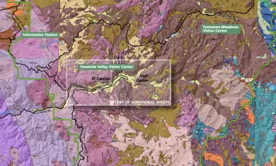
Location intelligence is transforming decision-making, with an increasing number and type of organizations modernizing operations with a geographic approach to problem-solving, planning, and prediction.

Location intelligence is the process of deriving meaningful insights from geospatial data to solve specific problems. This involves layering multiple data sets spatially and/or chronologically, for easy reference on a map, and its applications span industries, categories, and organizations. Location intelligence is facilitated by the use of geographical information system (GIS) tools which enable analysts to effectively and efficiently collect, stores, analyze, and visualize data.
Location intelligence experts can use a variety of spatial and business analytical tools to measure optimal locations for operating a business or providing a service. They begin with defining the business ecosystem which is influenced by many interconnected factors, including (but are not limited to): culture, lifestyle, labor, healthcare, cost of living, crime, economic climate, and education.
In this post, Esri, the well-known GIS software company, explains how leaders in business and government are applying location technology to meet a wide variety of needs. Examples of location intelligence use cases include finding optimal locations in retail site selection, managing assets in real time, supply chain optimization, and building or maintaining vital infrastructure. Esri points out that location is key to solving many of today's challenges as geography pulls together all key information about important issues such as infrastructure modernization, sustainability, climate change, environmental management, and social equity.
FULL STORY: Location Intelligence: Insights that transform decision-making

Study: Maui’s Plan to Convert Vacation Rentals to Long-Term Housing Could Cause Nearly $1 Billion Economic Loss
The plan would reduce visitor accommodation by 25,% resulting in 1,900 jobs lost.

North Texas Transit Leaders Tout Benefits of TOD for Growing Region
At a summit focused on transit-oriented development, policymakers discussed how North Texas’ expanded light rail system can serve as a tool for economic growth.

Why Should We Subsidize Public Transportation?
Many public transit agencies face financial stress due to rising costs, declining fare revenue, and declining subsidies. Transit advocates must provide a strong business case for increasing public transit funding.

How to Make US Trains Faster
Changes to boarding platforms and a switch to electric trains could improve U.S. passenger rail service without the added cost of high-speed rail.

Columbia’s Revitalized ‘Loop’ Is a Hub for Local Entrepreneurs
A focus on small businesses is helping a commercial corridor in Columbia, Missouri thrive.

Invasive Insect Threatens Minnesota’s Ash Forests
The Emerald Ash Borer is a rapidly spreading invasive pest threatening Minnesota’s ash trees, and homeowners are encouraged to plant diverse replacement species, avoid moving ash firewood, and monitor for signs of infestation.
Urban Design for Planners 1: Software Tools
This six-course series explores essential urban design concepts using open source software and equips planners with the tools they need to participate fully in the urban design process.
Planning for Universal Design
Learn the tools for implementing Universal Design in planning regulations.
City of Santa Clarita
Ascent Environmental
Institute for Housing and Urban Development Studies (IHS)
City of Grandview
Harvard GSD Executive Education
Toledo-Lucas County Plan Commissions
Salt Lake City
NYU Wagner Graduate School of Public Service


