


A new tool, released in partnership with the U.S. Geological Survey and Esri, provides easy access to historical maps from all over the country, featuring a timeline to easily select maps from different eras.
"Two of the nation's most authoritative mapping sources, the U.S. Geological Survey and Esri, have partnered to put the rich tapestry of U.S. Historical Maps into the hands of everyone. Available in time for the Fourth of July and able to be accessed on all digital devices, the USGS Historical Topographic Map Explorer brings to life more than 178,000 maps dating from 1884 to 2006," according to a press release from Esri.
For an example of the awesome breadth and depth of the archive available on the site, even my small hometown of Weaverville, California has historical maps, dating back to 1913.


FULL STORY: New York to LA: History of America’s Maps in One App


Friday Eye Candy: The Childhood Maps of 8 Professional Mapmakers
Choosing cartography as a career is a natural result of a lifelong love of maps. National Geographic gathers the proof.
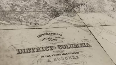
USGS Map Archive Now Easily Accessible
The U.S. Geological Survey has introduced topoView, an intuitive map-based tool making it far simpler to search and access its archive of 178,000 topographical maps dating from 1880 to 2010.

Friday Eye Candy: A Sorely-Needed Map of New York City Neighborhoods
Neighborhoods don't get the same official boundaries as cities, counties, states, and countries. So how do we know where one neighborhood ends and another begins?

Alabama: Trump Terminates Settlements for Black Communities Harmed By Raw Sewage
Trump deemed the landmark civil rights agreement “illegal DEI and environmental justice policy.”

Study: Maui’s Plan to Convert Vacation Rentals to Long-Term Housing Could Cause Nearly $1 Billion Economic Loss
The plan would reduce visitor accommodation by 25% resulting in 1,900 jobs lost.

Planetizen Federal Action Tracker
A weekly monitor of how Trump’s orders and actions are impacting planners and planning in America.

Wind Energy on the Rise Despite Federal Policy Reversal
The Trump administration is revoking federal support for renewable energy, but demand for new projects continues unabated.

Passengers Flock to Caltrain After Electrification
The new electric trains are running faster and more reliably, leading to strong ridership growth on the Bay Area rail system.

Texas Churches Rally Behind ‘Yes in God’s Back Yard’ Legislation
Religious leaders want the state to reduce zoning regulations to streamline leasing church-owned land to housing developers.
Urban Design for Planners 1: Software Tools
This six-course series explores essential urban design concepts using open source software and equips planners with the tools they need to participate fully in the urban design process.
Planning for Universal Design
Learn the tools for implementing Universal Design in planning regulations.
Caltrans
Smith Gee Studio
Institute for Housing and Urban Development Studies (IHS)
City of Grandview
Harvard GSD Executive Education
Toledo-Lucas County Plan Commissions
Salt Lake City
NYU Wagner Graduate School of Public Service