


Matt Flegenheimer reports on how newly found errors in New York's vaunted subway map have reignited a battle over who deserves credit for its design, and who should own up to its mistakes.
Replacing the previous design by Massimo Vignelli, the current New York subway map was always intended to be more artful than factual in its cartography. However, John Tauranac, who headed the committee given the daunting assignment in 1979 to update and redesign Vignelli's map, only uncovered some of its glaring geographic inaccuracies a few weeks ago.
"On the West Side of Manhattan, beginning near Lincoln Center and extending toward the campus of Columbia University, Broadway is seemingly misplaced. It is west of Amsterdam Avenue at West 66th Street when it should be east. It drifts toward West End Avenue near 72nd Street, where it should intersect with Amsterdam. It overtakes West End Avenue north of the avenue's actual endpoint near West 107th Street, creating several blocks of fictitious Upper West Side real estate."
"But Mr. Tauranac's sheepish discovery of the errors has at once rekindled and complicated a long-simmering debate over who deserves credit for the watershed 1979 guide," states Flegenheimer. Michael Hertz, whose firm was credited with designing the initial template for the map said, "He's overseeing the project," adding that he himself perhaps deserved some blame, but "not as much" as Mr. Tauranac. "I was not an expert on the geography of the city," he said.
The Metropolitan Transportation Authority will consider revising future subway map editions after taking into consideration these new findings.
FULL STORY: On the Vaunted City Subway Map, Mistakes and Phantom Blocks


Four New Map Books Reviewed
Looking for the perfect holiday gift for a planner? Check out these new map books.
New Book Highlights How GIS Improves Outcomes
Esri Press recently published a digital book called Mapping the Nation which demonstrates how a geographic approach guides important decisions and addresses challenges around the globe.
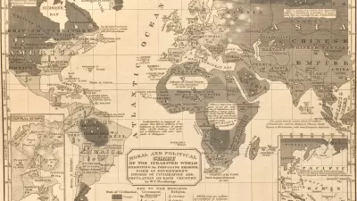
The Pseudoscientific Foundations of Racist Planning Practices
Racist and colonialist narratives in old geography textbooks help explain the prevalence of segregationist and discriminatory policies and other nasty planning practices. It’s time to understand and reconcile.

Alabama: Trump Terminates Settlements for Black Communities Harmed By Raw Sewage
Trump deemed the landmark civil rights agreement “illegal DEI and environmental justice policy.”

Study: Maui’s Plan to Convert Vacation Rentals to Long-Term Housing Could Cause Nearly $1 Billion Economic Loss
The plan would reduce visitor accommodation by 25% resulting in 1,900 jobs lost.

Planetizen Federal Action Tracker
A weekly monitor of how Trump’s orders and actions are impacting planners and planning in America.

Wind Energy on the Rise Despite Federal Policy Reversal
The Trump administration is revoking federal support for renewable energy, but demand for new projects continues unabated.

Passengers Flock to Caltrain After Electrification
The new electric trains are running faster and more reliably, leading to strong ridership growth on the Bay Area rail system.

Texas Churches Rally Behind ‘Yes in God’s Back Yard’ Legislation
Religious leaders want the state to reduce zoning regulations to streamline leasing church-owned land to housing developers.
Urban Design for Planners 1: Software Tools
This six-course series explores essential urban design concepts using open source software and equips planners with the tools they need to participate fully in the urban design process.
Planning for Universal Design
Learn the tools for implementing Universal Design in planning regulations.
Caltrans
Smith Gee Studio
Institute for Housing and Urban Development Studies (IHS)
City of Grandview
Harvard GSD Executive Education
Toledo-Lucas County Plan Commissions
Salt Lake City
NYU Wagner Graduate School of Public Service