


Maps
Website Opens Bay Area Transportation Data to the Masses
The Metropolitan Transportation Commission—the Bay Area's regional transportation planning agency—recently did fans of data and mapping a huge favor and launched a website called Vital Signs.
New Research Maps Transit Poverty
New research provides sorely needed tools for illustrating the neighborhoods that suffer a lack of transportation options to access jobs and opportunity.
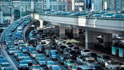
Mapping the Morning Commute
What time did you leave for work this morning? What time should you have left for work this morning?

A Map of Every Bridge in the United States
Mapping the nation's 600,000 bridges reveals a remarkably fine-grained map of…the nation.
A New Interactive Mapping Tool Showcases Chicago Region's Mobility Infrastructure Needs
A new interactive mapping tool, created by the Chicago Metropolitan Agency for Planning, makes the case for a renewed, regional focus on the infrastructure that moves the region.
Mapping U.S. Highway Intensity
A new map from Mapbox visualizes traffic on all roads eligible for highway safety funds by combining data available through the Highway Performance Monitoring System on OpenStreetMap.
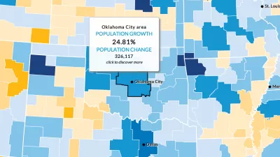
Mapping the Demographic Future of Cities
Cities change. The people living in cities change. A new online tool from the Urban Institute allows users to forecast demographic trends as far out at 2030.
An Interactive Map of California's Urban Water Use
California has commenced new water use reporting requirements, which the Pacific Institute has compiled into an interactive map and database to provide accessible evidence about where the state's water goes.
Mapping the Places Referenced by 224 State of the Union Speeches
If you're into place names and the history of presidential politics, we have just the map for you.
Pop Quiz: Can You Name Cities from their Transit Maps?
What better way to wind down from a long week thinking about cities and maps and transportation than by taking a quiz to show off your knowledge of cities and maps and transportation?
The First-Ever 'Ecological Land Units' Map of the World
A new web-based tool by the U.S. Geological Survey (USGS) and Esri allows users to "explore the ecological tapestry of the world."
Mapping Chicago's Current Wave of Transit Oriented Development Projects
Patrick Sisson reports on the fruits of a 2013 effort by the city of Chicago to codify transit oriented development.
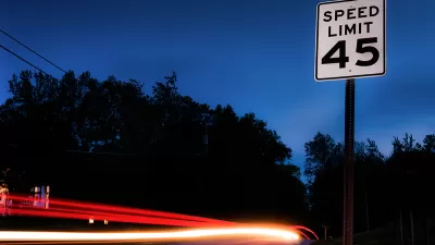
A Map of Worldwide Speed Limits
Do you have a need for speed? Or at least a need to know the speed limit anywhere in the world? Greater Greater Washington has just the map for you.
How Images Shape our Understanding of Places
An article by Ben Campkin, Marina Mogilevich, and Rebecca Ross examines how images shape ideas about cities—from "John Snow’s Cholera map to Le Corbusier's plan for a contemporary city and Moose's 'clean graffiti.'"
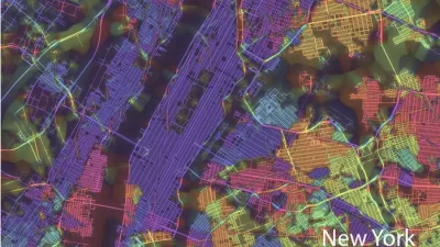
Friday Eye Candy: 'Crayon the Grids' City Mapping
Artist-scientist Stephen Von Worley is taking on a new project— mapping the world's city streets based on a complex set of algorithms and psychedelic colors.
MapStory Traces the Development of the United States
Interested in tracing the development of everything from urban bike lanes to national parks to rocket test sites?
Does the Evolution of Smartphones Come at the Expense of 'Spatial Thinking'?
Are smartphones supplementing the capacity of humans to think spatially, such that future generations might lose fundamental cognitive abilities?
The Truth about Viral Maps
Matthew Yglesias lets us peek behind the curtain of those viral maps that reveal difference between states. Hiding behind these maps is a dirty little secret about how little variation there is in America.
Ten Years of OpenStreetMap
Exactly how does a student take on an open data political stance and transform it into "the largest crowd-sourced mapping project on the internet"?
New York City's Crowdsourced Street Safety Map
As part of the Vision Zero initiative for traffic safety, the city has hosted a map system that allowed citizens to report safety issues encountered on the street. With the reporting period now over, you can still peruse the findings of the exercise.
Urban Design for Planners 1: Software Tools
This six-course series explores essential urban design concepts using open source software and equips planners with the tools they need to participate fully in the urban design process.
Planning for Universal Design
Learn the tools for implementing Universal Design in planning regulations.
City of Albany
UCLA Lewis Center for Regional Policy Studies
Mpact (formerly Rail~Volution)
Chaddick Institute at DePaul University
City of Piedmont, CA
Great Falls Development Authority, Inc.
HUDs Office of Policy Development and Research


