


New research provides sorely needed tools for illustrating the neighborhoods that suffer a lack of transportation options to access jobs and opportunity.
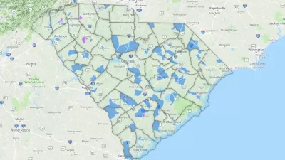
"Two Dutch researchers have developed a new way to identify where the residents are most at risk of transport poverty," according to an article by Cassie Ownes.
"Using their new index, [Karel] Martens and [Jeroen] Bastiaanssen first determine the 'average regional accessibility level.' Their formula assesses trips within zones against the number of jobs and poor households per census tract. Next, they reduce this regional average into fractions, like 20 percent or 30 percent of average access, to see where the transport poor might be."
Martens and Bastiaanssen produced original transit poverty maps to illustrate their work—exclusively for Next City—of Philadelphia, San Francisco, Seattle, and Houston.
FULL STORY: New Maps Size Up Transportation Poverty Risks in 4 Cities

District By District, Maps Trace Neighborhood Opportunity Across the U.S.
Down to the level of individual census tracts, a team of researchers has developed national maps showing where upward mobility is probable, and where it isn't.
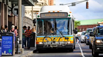
How Transportation Assistance Can Fight Homelessness
Transportation access is one of the biggest factors in keeping people out of homelessness. Cities can help with discounted fares and last-mile connections.

Poverty in the United States Explained
The Brookings Institution has provided a data-driven examination of the subject of poverty in the United States, to provide the kind of policy nuance and detail missing from the 2016 presidential campaign.

Alabama: Trump Terminates Settlements for Black Communities Harmed By Raw Sewage
Trump deemed the landmark civil rights agreement “illegal DEI and environmental justice policy.”

Planetizen Federal Action Tracker
A weekly monitor of how Trump’s orders and actions are impacting planners and planning in America.

The 120 Year Old Tiny Home Villages That Sheltered San Francisco’s Earthquake Refugees
More than a century ago, San Francisco mobilized to house thousands of residents displaced by the 1906 earthquake. Could their strategy offer a model for the present?

Ken Jennings Launches Transit Web Series
The Jeopardy champ wants you to ride public transit.

BLM To Rescind Public Lands Rule
The change will downgrade conservation, once again putting federal land at risk for mining and other extractive uses.

Indy Neighborhood Group Builds Temporary Multi-Use Path
Community members, aided in part by funding from the city, repurposed a vehicle lane to create a protected bike and pedestrian path for the summer season.
Urban Design for Planners 1: Software Tools
This six-course series explores essential urban design concepts using open source software and equips planners with the tools they need to participate fully in the urban design process.
Planning for Universal Design
Learn the tools for implementing Universal Design in planning regulations.
Clanton & Associates, Inc.
Jessamine County Fiscal Court
Institute for Housing and Urban Development Studies (IHS)
City of Grandview
Harvard GSD Executive Education
Toledo-Lucas County Plan Commissions
Salt Lake City
NYU Wagner Graduate School of Public Service