


The Metropolitan Transportation Commission—the Bay Area's regional transportation planning agency—recently did fans of data and mapping a huge favor and launched a website called Vital Signs.
"Data lovers can now nerd out on a new website that collects Bay Area transportation data and puts it into customizable maps and charts that anyone can play with," reports Melanie Curry.
The website, called Vital Signs, is part of an open data project by the Metropolitan Transportation Commission (MTC), and could inform measurements if/when the beleaguered Plan Bay Area effort begins to shape the region.
"The first rollout of the website includes transportation data from a variety of sources, including the US Census. Land use data will be added in March. Information and measures of the economy–job creation, employment, and housing affordability–and environment—emissions, fuel sales, injuries from collisions–will complete the website by June," according to Curry's sources with the MTC.
Curry goes on to detail some of the uses of the portal, including comparisons between San Francisco and Los Angeles on measures of annual and daily transit ridership.
Members of the mainstream have already picked up on the tools available through Vital Signs, including Gary Richards for the Contra Costa Times and Ann Notarangelo for CBS SF Bay Area.
FULL STORY: New Data Website Tracks Bay Area Vital Signs

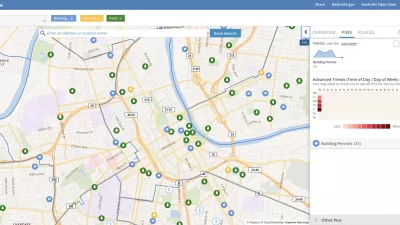
Presenting Municipal Data in an Interactive Map, Nashville Style
The city of Nashville launched the NashView interactive data map earlier this month.

DataUSA: An Intuitive Tool for Public Data
A collaboration between Deloitte, Datawheel, and MIT has produced an intuitive aesthetically-pleasing gathering point for public data in the United States. Specific locations and industries boast easy-to-read profiles.
Putting Alternative Fuel Stations on the Map
Yesterday, the U.S. Department of Energy released an interactive map displaying thousands of alternative fuel stations around the nation.

Alabama: Trump Terminates Settlements for Black Communities Harmed By Raw Sewage
Trump deemed the landmark civil rights agreement “illegal DEI and environmental justice policy.”

Planetizen Federal Action Tracker
A weekly monitor of how Trump’s orders and actions are impacting planners and planning in America.

The 120 Year Old Tiny Home Villages That Sheltered San Francisco’s Earthquake Refugees
More than a century ago, San Francisco mobilized to house thousands of residents displaced by the 1906 earthquake. Could their strategy offer a model for the present?

Ken Jennings Launches Transit Web Series
The Jeopardy champ wants you to ride public transit.

BLM To Rescind Public Lands Rule
The change will downgrade conservation, once again putting federal land at risk for mining and other extractive uses.

Indy Neighborhood Group Builds Temporary Multi-Use Path
Community members, aided in part by funding from the city, repurposed a vehicle lane to create a protected bike and pedestrian path for the summer season.
Urban Design for Planners 1: Software Tools
This six-course series explores essential urban design concepts using open source software and equips planners with the tools they need to participate fully in the urban design process.
Planning for Universal Design
Learn the tools for implementing Universal Design in planning regulations.
Clanton & Associates, Inc.
Jessamine County Fiscal Court
Institute for Housing and Urban Development Studies (IHS)
City of Grandview
Harvard GSD Executive Education
Toledo-Lucas County Plan Commissions
Salt Lake City
NYU Wagner Graduate School of Public Service