


State and local officials are zeroing in on some of the region’s most dangerous streets and transit corridors.
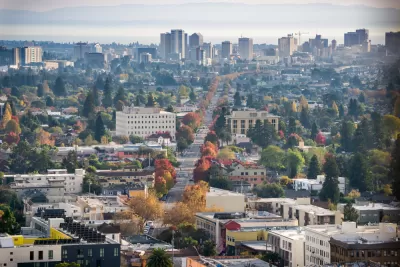
Safety improvements are coming to a major street in Oakland, California, reports Kristin J. Bender in The Mercury News, after 18 or more pedestrians were killed on International Boulevard in the last two years. “Improvements are being funded by a $400,000 grant from the Metropolitan Transportation Commission and $1.8 million from the city of Oakland, officials said.”
The project joins other efforts to make Bay Area streets safer and more connected for pedestrians, transit users, and cyclists. In San Mateo County, the local transportation authority plans to improve sidewalk crossings and bike and pedestrian routes that connect to Caltrain, BART, and other public transit. “That could include building pathways over or under the elevated Caltrain tracks and adjacent Highway 101 corridor to better connect the downtown area to the city’s job center and biotech hub in its former industrial core to the east.”
Bender notes that “last week, the Regional Network Management Council, a coalition of Bay Area transit agencies, earmarked more than $18 million for eight projects under the Bus Accelerated Infrastructure Delivery program, commonly known as ‘BusAID.’” The program is designed to improve bus speed and reliability and make key transit corridors safer for all users.
FULL STORY: Deadly Bay Area streets spark officials to make traffic safety improvements

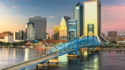
Jacksonville Takes Action on Vision Zero
The city is implementing its first-ever Vision Zero Action Plan in an effort to reduce pedestrian and cyclist deaths and serious injuries.

‘Complete Streets’ Webpage Deleted in Federal Purge
Basic resources and information on building bike lanes and sidewalks, formerly housed on the government’s Complete Streets website, are now gone.
NACTO Releases Updated Urban Bikeway Guide
The third edition of the nationally recognized road design guide includes detailed design advice for roads that prioritize safety and accessibility for all users.

Alabama: Trump Terminates Settlements for Black Communities Harmed By Raw Sewage
Trump deemed the landmark civil rights agreement “illegal DEI and environmental justice policy.”

Planetizen Federal Action Tracker
A weekly monitor of how Trump’s orders and actions are impacting planners and planning in America.

The 120 Year Old Tiny Home Villages That Sheltered San Francisco’s Earthquake Refugees
More than a century ago, San Francisco mobilized to house thousands of residents displaced by the 1906 earthquake. Could their strategy offer a model for the present?

BLM To Rescind Public Lands Rule
The change will downgrade conservation, once again putting federal land at risk for mining and other extractive uses.

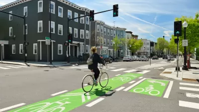
Indy Neighborhood Group Builds Temporary Multi-Use Path
Community members, aided in part by funding from the city, repurposed a vehicle lane to create a protected bike and pedestrian path for the summer season.

Congestion Pricing Drops Holland Tunnel Delays by 65 Percent
New York City’s contentious tolling program has yielded improved traffic and roughly $100 million in revenue for the MTA.
Urban Design for Planners 1: Software Tools
This six-course series explores essential urban design concepts using open source software and equips planners with the tools they need to participate fully in the urban design process.
Planning for Universal Design
Learn the tools for implementing Universal Design in planning regulations.
Clanton & Associates, Inc.
Jessamine County Fiscal Court
Institute for Housing and Urban Development Studies (IHS)
City of Grandview
Harvard GSD Executive Education
Toledo-Lucas County Plan Commissions
Salt Lake City
NYU Wagner Graduate School of Public Service