


Most Presidential libraries and museums have some transit accessibility, but none are in big-city downtowns.


After President Carter’s death, transit consultant Jarrett Walker wrote on Bluesky that the Carter Presidential Library and Museum was in a “transit inaccessible location” (though Google Maps claims that it is on a bus line and is a 17-minute walk from the Inman Park Atlanta subway station). This post made me wonder: how does the Carter library compare with other Presidential museums? And how accessible are Presidential museums generally to non-drivers?
Presidential library/museum locations seem to fall into four general categories: Small town (Hoover, Eisenhower), suburban (Roosevelt, Truman, Reagan, Bush the elder), urban-ish (Kennedy, Carter, Johnson, Bush the younger, Obama) and downtown (Ford, Clinton).
The “small town” museums are typically in places that are very walkable but too isolated for public transit. The oldest library/museum, and once of the most rural, is that of Herbert Hoover. While Hoover himself retired to Manhattan, the Hoover library is in the middle of West Branch, Iowa, a tiny town that is too small for Greyhound or public transit. If I were to travel to West Branch without a car, the best way to do it is to take Greyhound to Iowa City 12 miles away and then take a taxicab. Alternatively, I could walk four hours from Iowa City, which I could do in good weather. Similarly, the Eisenhower Library, like the Hoover Library, is in the center of a small town (Abilene, Kansas). But unlike the Hoover Library it is not near a significant city — so even though it gets high grades on walkability it gets very low grades on transit.
Most of the suburban libraries are bus-accessible, though they are a two-seat ride from the nearest urban core. The Roosevelt, Nixon, and Truman libraries all fit this description. President Franklin Roosevelt’s library is in Hyde Park in Duchess County; to get there from Manhattan, I would have to take a commuter train to Poughkeepsie, then take a local bus to the FDR home. However, the home is right next to the bus stop. The library has a not-great Walkscore of 27. The Truman Library, like the Hoover one, is in the middle of a small town (Independence, Missouri) and thus has a better Walkscore than the Roosevelt Library (52). However, Independence is close enough to Kansas City to essentially be a Kansas City suburb, and thus is accessible by Kansas City public transit. Like the Roosevelt library, it is not a one-seat ride from a major downtown: you could take a Kansas City bus to downtown Independence, and then ride a mile or two on local Independence transit. Similarly, the Nixon Library is in Yorba Linda, a Los Angeles suburb: to get there you’d have to take a commuter train to Fullerton in Orange County, then spend about an hour on an Orange County Transit bus. Surprisingly, the Nixon Library has a Walkscore of 81. However, commercial streets near this library look like they are a bit wide for my comfort, and probably should be crossed with great caution if you fear death at the hands of a speeding automobile. (On the other hand, I highly recommend them to people who do not fear death). The George H.W. Bush Library is somewhat analogous: it appears to be at the southern edge of College Station, Texas and requires two bus rides from downtown College Station (one a university-run shuttle through the Texas A&M campus where the library is located).
Only one of the suburban libraries has minimal-to-nonexistent accessibility: the Reagan Library’s location in Simi Valley appears to be about a 75-minute walk from the nearest bus stop (served by Simi Valley's local buses).
A third category of museum/library is the “urban but not downtown” museum. These museums are typically a medium-length walk from rail transit but have adequate bus service. The George W. Bush museum is on the Southern Methodist University campus and (according to Google Maps) a 13-minute walk from Dallas’ Mockingbird rail station, and only an 8-minute bus ride. Similarly, the John F. Kennedy library is in Boston, not very close to rail transit but much closer to a bus stop- and as noted above, the same is true for Jimmy Carter’s library in Atlanta. The Johnson library is on the University of Texas campus in Austin, very close to a city bus stop. Although the Obama museum in Chicago’s Jackson Park has not yet opened, maps suggest that it will be a block from the commuter trains at 59th Street in Chicago, although much further from the El.
Two museums are located in downtowns of mid-sized cities. President Ford’s museum is perhaps one of the most urban museums: in the heart of downtown Grand Rapids. (However, the library is located at the University of Michigan at the other end of the state). Similarly, President Clinton’s museum is in the heart of downtown Little Rock. However, both Grand Rapids and Little Rock have far less transit service than larger cities such as Dallas, Boston, and Atlanta.
One thing that surprised me: with the dreadful exception of the Reagan museum, there doesn’t seem to be a strong correlation between ideology and museum location. The two most urban museums honor one moderate Republican (Ford) and one moderate Democrat (Carter). I think most Americans would guess that the most conservative President of recent decades other than Reagan is George W. Bush and that the most liberal President was Obama, but both Presidents’ libraries have above-average transit-accessibility.


Opinion: California’s SB 79 Would Improve Housing Affordability and Transit Access
A proposed bill would legalize transit-oriented development statewide.
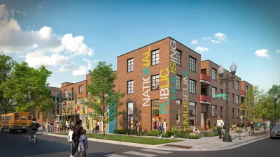
Museum of Public Housing Opens in Chicago
The museum highlights the history of public housing in the United States using displays intimately woven with family artifacts.
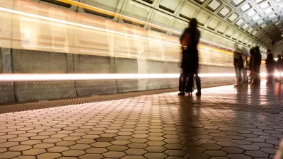
Mobile App Makes DC Transit Easy to Navigate for Visually Impaired Riders
The app gives step-by-step directions and audio and visual cues accessible from anywhere for thousands of bus stops and rail stations.

Alabama: Trump Terminates Settlements for Black Communities Harmed By Raw Sewage
Trump deemed the landmark civil rights agreement “illegal DEI and environmental justice policy.”

Planetizen Federal Action Tracker
A weekly monitor of how Trump’s orders and actions are impacting planners and planning in America.

The 120 Year Old Tiny Home Villages That Sheltered San Francisco’s Earthquake Refugees
More than a century ago, San Francisco mobilized to house thousands of residents displaced by the 1906 earthquake. Could their strategy offer a model for the present?

LA’s Tree Emergency Goes Beyond Vandalism
After a vandal destroyed dozens of downtown LA trees, Mayor Karen Bass vowed to replace them. Days later, she slashed the city’s tree budget.

Sacramento Leads Nation With Bus-Mounted Bike Lane Enforcement Cameras
The city is the first to use its bus-mounted traffic enforcement system to cite drivers who park or drive in bike lanes.

Seattle Voters Approve Social Housing Referendum
Voters approved a corporate tax to fund the city’s housing authority despite an opposition campaign funded by Amazon and Microsoft.
Urban Design for Planners 1: Software Tools
This six-course series explores essential urban design concepts using open source software and equips planners with the tools they need to participate fully in the urban design process.
Planning for Universal Design
Learn the tools for implementing Universal Design in planning regulations.
Ada County Highway District
Clanton & Associates, Inc.
Jessamine County Fiscal Court
Institute for Housing and Urban Development Studies (IHS)
City of Grandview
Harvard GSD Executive Education
Toledo-Lucas County Plan Commissions
Salt Lake City
NYU Wagner Graduate School of Public Service