


The app gives step-by-step directions and audio and visual cues accessible from anywhere for thousands of bus stops and rail stations.
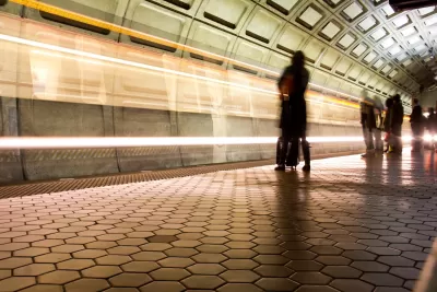
Passengers with visual impairments on the D.C.-area transit system can now use an app to navigate the network, making the Washington Metropolitan Area Transit Authority’s system one of the nation’s most accessible, according to a press release from app developer Waymap.
As Kea Wilson explains in an article in Streetsblog USA, the app relies on the phone’s motion sensors to let users navigate even underground, making it potentially “the first and only indoor mapping service that requires no external infrastructure to work.” It also provides turn-by-turn audio cues and touts “step-level accuracy.”
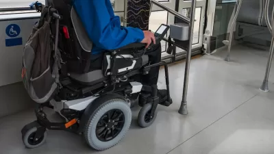
Wilson’s article points out that the app has had unexpected benefits for users beyond people with visual impairments. “Users can request routes that avoid stairs, escalators, and elevators, for instance, or ask the app to send them alerts about the exact location of wheelchair ramps before they leave the house and find themselves stranded without one. They can fine tune the speed and pitch of audio alerts to match their preferences and cognitive needs, as well as switch between four different languages.”
The company hopes the app can offer a more inclusive transit experience and plans to expand to more cities, as well as map the interior of other locations such as grocery stores and hospitals to offer a more complete end-to-end travel experience. While Washington, D.C. is the first system to be fully available on the platform, the app is also live in some locations in other cities including Los Angeles, Brisbane, Australia, and Madrid, Spain.
FULL STORY: This App Could Make D.C. One of the Most Accessible Transit Networks In the World

USDOT Issues Accessibility Guidelines for Transit Stations
A new rule aims to clarify accessibility requirements to help state and local DOTs upgrade their facilities more quickly to meet ADA standards.
Report: NYC Transit Accessibility Depends on Congestion Pricing Revenue
The ability of the MTA to complete its accessibility upgrades relies on funding from the upcoming congestion pricing program.
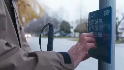
Braille Signage Now at All Vancouver Bus Stops
The city completed installation of signage for people with visual impairments at over 8,000 bus stops.

Alabama: Trump Terminates Settlements for Black Communities Harmed By Raw Sewage
Trump deemed the landmark civil rights agreement “illegal DEI and environmental justice policy.”

Planetizen Federal Action Tracker
A weekly monitor of how Trump’s orders and actions are impacting planners and planning in America.

The 120 Year Old Tiny Home Villages That Sheltered San Francisco’s Earthquake Refugees
More than a century ago, San Francisco mobilized to house thousands of residents displaced by the 1906 earthquake. Could their strategy offer a model for the present?

Ken Jennings Launches Transit Web Series
The Jeopardy champ wants you to ride public transit.

BLM To Rescind Public Lands Rule
The change will downgrade conservation, once again putting federal land at risk for mining and other extractive uses.

Indy Neighborhood Group Builds Temporary Multi-Use Path
Community members, aided in part by funding from the city, repurposed a vehicle lane to create a protected bike and pedestrian path for the summer season.
Urban Design for Planners 1: Software Tools
This six-course series explores essential urban design concepts using open source software and equips planners with the tools they need to participate fully in the urban design process.
Planning for Universal Design
Learn the tools for implementing Universal Design in planning regulations.
Clanton & Associates, Inc.
Jessamine County Fiscal Court
Institute for Housing and Urban Development Studies (IHS)
City of Grandview
Harvard GSD Executive Education
Toledo-Lucas County Plan Commissions
Salt Lake City
NYU Wagner Graduate School of Public Service