


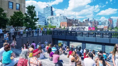
New York's lack of sunlight might be overstated, but the New York Times mapped the shadows cast by every building on every block of the city just to be sure.

The New York Times has produced a series of artful maps that illustrates "all of the shadows produced by thousands of buildings in New York City over the course of one day."
Quoctrung Bui and Jeremy White provide the context for the maps, noting that in most parts of America, "sunlight is not debated the way it is in New York, where the city’s thirst for living space, working space and economic growth has turned the sun into a virtual commodity."
Planning, and specifically zoning, has been at the center of the debate for decades, according to the article.
The city’s first attempt at light preservation was through a setback rule. As successive buildings grew taller, they would have to be continually set back a couple of feet from the street (like the Empire State Building), producing the classic wedding-cake style of skyscraper. Decades later, in the 1960s, the city overhauled this rule in favor of a floor-area ratio model, which tended to produce tall, narrow structures with open plazas at the base (like the Seagram Building).
The article includes three maps, presenting the variations between the seasons.
FULL STORY: Mapping the Shadows of New York City: Every Building, Every Block

Friday Eye Candy: A Sorely-Needed Map of New York City Neighborhoods
Neighborhoods don't get the same official boundaries as cities, counties, states, and countries. So how do we know where one neighborhood ends and another begins?
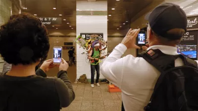
Friday Eye Candy: The Theatricality of the Subway
A new book of photography amplifies what was already there.
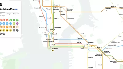
The New New York Subway Map Works in Real Time
There's a new chapter, and maybe an end, for the "Great Subway Map Debate."

Alabama: Trump Terminates Settlements for Black Communities Harmed By Raw Sewage
Trump deemed the landmark civil rights agreement “illegal DEI and environmental justice policy.”

Planetizen Federal Action Tracker
A weekly monitor of how Trump’s orders and actions are impacting planners and planning in America.

The 120 Year Old Tiny Home Villages That Sheltered San Francisco’s Earthquake Refugees
More than a century ago, San Francisco mobilized to house thousands of residents displaced by the 1906 earthquake. Could their strategy offer a model for the present?

In Both Crashes and Crime, Public Transportation is Far Safer than Driving
Contrary to popular assumptions, public transportation has far lower crash and crime rates than automobile travel. For safer communities, improve and encourage transit travel.

Report: Zoning Reforms Should Complement Nashville’s Ambitious Transit Plan
Without reform, restrictive zoning codes will limit the impact of the city’s planned transit expansion and could exclude some of the residents who depend on transit the most.

Judge Orders Release of Frozen IRA, IIJA Funding
The decision is a victory for environmental groups who charged that freezing funds for critical infrastructure and disaster response programs caused “real and irreparable harm” to communities.
Urban Design for Planners 1: Software Tools
This six-course series explores essential urban design concepts using open source software and equips planners with the tools they need to participate fully in the urban design process.
Planning for Universal Design
Learn the tools for implementing Universal Design in planning regulations.
Clanton & Associates, Inc.
Jessamine County Fiscal Court
Institute for Housing and Urban Development Studies (IHS)
City of Grandview
Harvard GSD Executive Education
Toledo-Lucas County Plan Commissions
Salt Lake City
NYU Wagner Graduate School of Public Service