


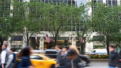
One out of ten New Yorkers gets lost every week, according to the city's Department of Transportation, and this does not include out-of-towners. In March, the city will begin installing 150 wayfinding signs to help pedestrians navigate their way.
“Whether you’re a life-long New Yorker or a first-time visitor, everyone knows the feeling of walking out of a building or a subways station and being turned around, not knowing where you are,” said Janette Sadik-Khan, Transportation Commissioner. “These maps will help everyone in the city get around.” The signs will be located at high-traffic pedestrian locations in Midtown, Chinatown, Long Island City and Prospect Heights and Western Crown Heights. A sample shows that they will include major landmarks, local businesses, and estimated transit times within a 5-minute proximity. What's innovative is that these new maps will be laser printed directly on glass, adds Matt Chaban, and they will be formatted in "'heads-up mapping,' meaning that they are oriented the way a person is looking."
The winning bid for the project comes from PentaCity, a group made up of graphic design studio Pentagram, map makers City ID and industrial designers Billings Jackson. Pentagram has collaborated with the city on other recent projects including the the LOOK safety campaign and new parking signs.
The $6 million project was funded largely by the federal Department of Transportation, and most of the rest from local business improvement districts (BIDs). Many BIDs already have their own signs, says Chaban, but "[t]he goal was to unify all the wayfinding signage, including a new font called Helvetica DOT that Pentagram designed special for the department, a throwback to the same font gracing the subways." The city believes that the signs will help people learn the city better, and Sadik-Khan said, "That's good for business, that's good for communities, that's good for everybody. People will start to mix it up, exploring new neighborhoods and even new blocks in their old neighborhoods."
FULL STORY: Lost City of New York: New Sleek DOT Signs Help Pedestrians Find Their Way

NYC Officials Split on Jaywalking Decriminalization
While some council members say the ‘outdated’ practice disproportionately impacts Black and Latino residents, law enforcement officials say its a necessary measure for road safety.

Crosswalks Near NYC Schools More Dangerous Than Average
A child and a crossing guard were killed in school crosswalks within one week as the NYPD cuts crossing guard jobs.
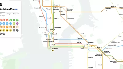
The New New York Subway Map Works in Real Time
There's a new chapter, and maybe an end, for the "Great Subway Map Debate."

Trump Administration Could Effectively End Housing Voucher Program
Federal officials are eyeing major cuts to the Section 8 program that helps millions of low-income households pay rent.

Planetizen Federal Action Tracker
A weekly monitor of how Trump’s orders and actions are impacting planners and planning in America.

Ken Jennings Launches Transit Web Series
The Jeopardy champ wants you to ride public transit.

Tackling Soil Contamination With Nature-Based Solutions
Los Angeles County residents and experts are turning to nature-based methods like bioremediation to address long-standing and fire-exacerbated soil contamination without resorting to costly and disruptive removal.

Rebuilding Smarter: How LA County Is Guiding Fire-Ravaged Communities Toward Resilience
Los Angeles County is leading a coordinated effort to help fire-impacted communities rebuild with resilience by providing recovery resources, promoting fire-wise design, and aligning reconstruction with broader sustainability and climate goals.

When Borders Blur: Regional Collaboration in Action
As regional challenges outgrow city boundaries, “When Borders Blur” explores how cross-jurisdictional collaboration can drive smarter, more resilient urban planning, sharing real-world lessons from thriving partnerships across North America.
Urban Design for Planners 1: Software Tools
This six-course series explores essential urban design concepts using open source software and equips planners with the tools they need to participate fully in the urban design process.
Planning for Universal Design
Learn the tools for implementing Universal Design in planning regulations.
Ada County Highway District
Clanton & Associates, Inc.
Jessamine County Fiscal Court
Institute for Housing and Urban Development Studies (IHS)
City of Grandview
Harvard GSD Executive Education
Toledo-Lucas County Plan Commissions
Salt Lake City
NYU Wagner Graduate School of Public Service