


Alexis C. Madrigal get exclusive access to "Ground Truth," Google's project to develop the most accurate maps in the world. But why is the master of the virtual world so intent on documenting the physical world?
As Madrigal explains, Google's commitment to documenting the physical world serves two purposes. First, it fits within the company's core mission to organize all the world's information. "'If you look at the offline world, the real world in which we live, that
information is not entirely online,' Manik Gupta, the senior product
manager for Google Maps, told [Madrigal]. 'Increasingly as we go about our
lives, we are trying to bridge that gap between what we see in the real
world and [the online world], and Maps really plays that part.'"
The last item mentioned by Gupta plays into the project's second purpose: to compete with Apple over who will control the future of mobile phones. "If you're at all like
me," says Madrigal, "you use mapping more than any other application except for the
communications suite (phone, email, social networks, and text
messaging)...Whereas Apple's strengths are in product design, supply chain
management, and retail marketing, Google's most obvious realm of
competitive advantage is in information. Geo data -- and the apps built
to use it -- are where Google can win just by being Google."
What follows in the article is a fascinating peek inside the process to collect, engineer, and make operative the complex set of information hidden behind every Google Map.
"As we slip and slide into a world where our augmented reality is
increasingly visible to us off and online, Google's geographic data may
become its most valuable asset," concludes Madrigal. "Not solely because of this data alone,
but because location data makes everything else Google does and knows
more valuable."
"Or as my friend and sci-fi novelist
Robin Sloan put it to me, 'I maintain that this is Google's core asset.
In 50 years, Google will be the self-driving car company (powered by
this deep map of the world) and, oh, P.S. they still have a search
engine somewhere.'"
FULL STORY: How Google Builds Its Maps—and What It Means for the Future of Everything

How Google Maps Gets the 'Ground Truth' for Street View
A peak under the hood at "Ground Truth"—the operation behind Google Street View.

Google Maps Introduces New Transit, EV Features
It will now be easier to find electric car charging stations and transit options.
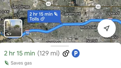
Google Maps Feature Identifies Most Fuel-Efficient Routes
A new feature highlights routes that use the least gas to help users make the most fuel-efficient driving decisions.

Alabama: Trump Terminates Settlements for Black Communities Harmed By Raw Sewage
Trump deemed the landmark civil rights agreement “illegal DEI and environmental justice policy.”

Planetizen Federal Action Tracker
A weekly monitor of how Trump’s orders and actions are impacting planners and planning in America.

The 120 Year Old Tiny Home Villages That Sheltered San Francisco’s Earthquake Refugees
More than a century ago, San Francisco mobilized to house thousands of residents displaced by the 1906 earthquake. Could their strategy offer a model for the present?

LA’s Tree Emergency Goes Beyond Vandalism
After a vandal destroyed dozens of downtown LA trees, Mayor Karen Bass vowed to replace them. Days later, she slashed the city’s tree budget.

Sacramento Leads Nation With Bus-Mounted Bike Lane Enforcement Cameras
The city is the first to use its bus-mounted traffic enforcement system to cite drivers who park or drive in bike lanes.

Seattle Voters Approve Social Housing Referendum
Voters approved a corporate tax to fund the city’s housing authority despite an opposition campaign funded by Amazon and Microsoft.
Urban Design for Planners 1: Software Tools
This six-course series explores essential urban design concepts using open source software and equips planners with the tools they need to participate fully in the urban design process.
Planning for Universal Design
Learn the tools for implementing Universal Design in planning regulations.
Ada County Highway District
Clanton & Associates, Inc.
Jessamine County Fiscal Court
Institute for Housing and Urban Development Studies (IHS)
City of Grandview
Harvard GSD Executive Education
Toledo-Lucas County Plan Commissions
Salt Lake City
NYU Wagner Graduate School of Public Service