


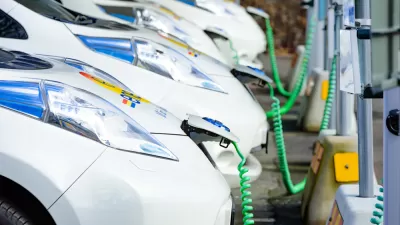
It will now be easier to find electric car charging stations and transit options.

New features on Google Maps will make it easier to find electric car charging stations and public transit information, reports Chris Smith in BGR.
As Smith explains, Google Maps will start including transit options by default along with driving directions in some cities. “If you prefer public transit over other alternatives, you’ll also love another feature Google just launched for Google Search. You can perform searches along the lines of ‘Boston to Philadelphia train,’ and you’ll get schedules and ticket prices, complete with links to the relevant booking options. The feature will also support searches for buses.”
For electric car drivers, Google Maps will collect user-generated data to find the nearest EV charging locations, and, in some cases, real-time port availability.
FULL STORY: Google Maps and Search add new AI features for EVs, plus new public transit features

Report: Transportation Equity Requires More Than Electrification
Lower-income households often lack the resources to buy electric cars, signaling a need for a more holistic approach to improving mobility and lowering transportation costs.

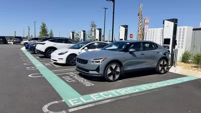
Rivian Joins Movement Toward Universal EV Charging
As more automakers like Tesla, Ford, and Rivian make their charging infrastructure compatible, the shift could lead to the faster development of a nationwide EV charging network.
Florida Law Bars Cities From Regulating EV Chargers
Under the new law, cities cannot require charging infrastructure in local codes.

Alabama: Trump Terminates Settlements for Black Communities Harmed By Raw Sewage
Trump deemed the landmark civil rights agreement “illegal DEI and environmental justice policy.”

Study: Maui’s Plan to Convert Vacation Rentals to Long-Term Housing Could Cause Nearly $1 Billion Economic Loss
The plan would reduce visitor accommodation by 25% resulting in 1,900 jobs lost.

Planetizen Federal Action Tracker
A weekly monitor of how Trump’s orders and actions are impacting planners and planning in America.

Waymo Gets Permission to Map SF’s Market Street
If allowed to operate on the traffic-restricted street, Waymo’s autonomous taxis would have a leg up over ride-hailing competitors — and counter the city’s efforts to grow bike and pedestrian on the thoroughfare.

Parklet Symposium Highlights the Success of Shared Spaces
Parklets got a boost during the Covid-19 pandemic, when the concept was translated to outdoor dining programs that offered restaurants a lifeline during the shutdown.

Federal Homelessness Agency Places Entire Staff on Leave
The U.S. Interagency Council on Homelessness is the only federal agency dedicated to preventing and ending homelessness.
Urban Design for Planners 1: Software Tools
This six-course series explores essential urban design concepts using open source software and equips planners with the tools they need to participate fully in the urban design process.
Planning for Universal Design
Learn the tools for implementing Universal Design in planning regulations.
Caltrans
Smith Gee Studio
Institute for Housing and Urban Development Studies (IHS)
City of Grandview
Harvard GSD Executive Education
Toledo-Lucas County Plan Commissions
Salt Lake City
NYU Wagner Graduate School of Public Service