


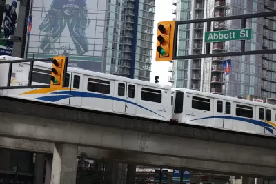
Questions about the variables that could significantly alter the future of transportation, and the configuration of the public realm to accommodate those futuristic forms of transportation, illustrate the potential power of scenario planning.
Anthony Flint asks the question: In a time when "new forms of transportation are creating many unknowns," are contemporary streetscape designs fully anticipating the future?
After presenting the example of a development at a prominent corner of Kenmore Square in Boston—a hotel development that "hinges on a complete re-routing of traffic to favor bicyclists and pedestrians, adding big swaths of public space in the process—Flint goes on to pose the significant unknowns challenging all current transportation thinking.
For example, the imminent arrival of autonomous cars may allow narrower streets because driverless cars can essentially tailgate each other. Timed traffic signals, guided by artificial intelligence, will keep things flowing in ways far superior to the red light, green light system of today. Downtowns everywhere won’t have to devote prized urban land for big parking garages or surface lots.
But shared autonomous vehicles may also end up exacerbating Boston’s first-in-the-nation congestion problems. One study predicts that driverless Ubers and Lyfts will be in such continual use, circling the block looking for rides, key streets in major metropolitan areas will see more gridlock than ever before.
Additional technologically advanced mobility mechanisms will also operate in the public realm of the future, like electric scooters and delivery robots. Both are already are already operating in some corners of the United States.
As a tool to anticipate these challenges, Flint suggests scenario planning, described here as allowing planners "to map out multiple scenarios, leaving room for unknowns."
"When conditions on the ground indicate that one of the scenarios is more likely, that’s the trigger for going all-in on infrastructure, policies, and placemaking," according to Flint.
FULL STORY: We’re redesigning our streetscape — but what if we’re getting it all wrong?


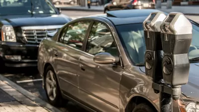
State of Curbs & Parking Report Reveals Glut of Data
As the uses of curb space become more diverse, city officials are working to understand how to best manage this increasingly important urban amenity.
Boston Could Introduce Parking Benefit Districts
The approach offers a way for cities to free up curb parking space while boosting revenue for local infrastructure.
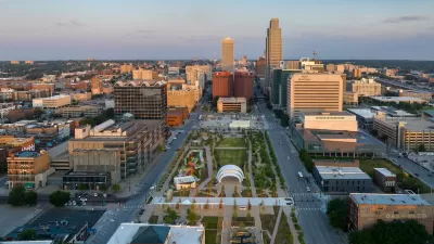
Downtown Omaha Planning for its Post-One-Way-Streets Era
The Omaha City Council has decided to reverse the transportation model adopted in the city in the 1950s, for the benefit of traffic safety and local retail activity.

Alabama: Trump Terminates Settlements for Black Communities Harmed By Raw Sewage
Trump deemed the landmark civil rights agreement “illegal DEI and environmental justice policy.”

Planetizen Federal Action Tracker
A weekly monitor of how Trump’s orders and actions are impacting planners and planning in America.

The 120 Year Old Tiny Home Villages That Sheltered San Francisco’s Earthquake Refugees
More than a century ago, San Francisco mobilized to house thousands of residents displaced by the 1906 earthquake. Could their strategy offer a model for the present?

Ken Jennings Launches Transit Web Series
The Jeopardy champ wants you to ride public transit.

BLM To Rescind Public Lands Rule
The change will downgrade conservation, once again putting federal land at risk for mining and other extractive uses.

Indy Neighborhood Group Builds Temporary Multi-Use Path
Community members, aided in part by funding from the city, repurposed a vehicle lane to create a protected bike and pedestrian path for the summer season.
Urban Design for Planners 1: Software Tools
This six-course series explores essential urban design concepts using open source software and equips planners with the tools they need to participate fully in the urban design process.
Planning for Universal Design
Learn the tools for implementing Universal Design in planning regulations.
Clanton & Associates, Inc.
Jessamine County Fiscal Court
Institute for Housing and Urban Development Studies (IHS)
City of Grandview
Harvard GSD Executive Education
Toledo-Lucas County Plan Commissions
Salt Lake City
NYU Wagner Graduate School of Public Service