


Boston
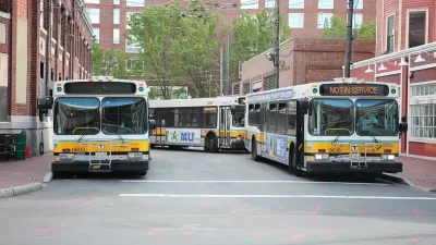
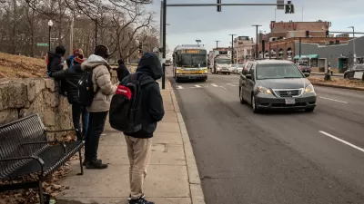
Boston Bus Signal Priority Project Yields Faster Travel Times
The city now plans to expand a year-long pilot project that reduced the time buses waited at traffic signals.
Boston Rail Network Sees Significant Increases in Speed After Eliminating ‘Slow Zones’
A year-long project that upgraded rail infrastructure and equipment has resulted in faster trips on all rail lines.

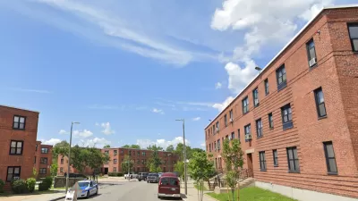
Boston Launches New Affordable Housing Preservation Fund
The Boston Acquisition Fund will offer low-interest loans to developers who pledge to keep multifamily housing affordable.

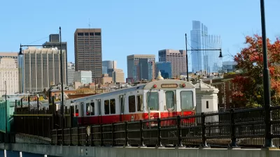
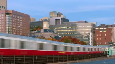
MBTA Red Line Now Free of ‘Slow Zones’
Recent work on the Boston-area rail line is making service on the aging system faster and more reliable.

Boston Affordable Housing Program Meets 1,000-Unit Goal
The program offers zero-interest loans to developers that keep rental units affordable for at least 50 years.

Massachusetts TOD Law Yielding Results
While some cities are fighting the state’s push to increase density near transit, others are already breaking ground on multifamily projects that will bring hundreds of new housing units online.

MBTA to Electrify its First Commuter Rail Line
The Massachusetts Bay Transportation Authority will electrify the 9 mile Fairmount Line, the shortest of their 12 commuter rail lines, using battery-electric multiple units. The first BEMU trains are projected to be operating in early 2028.

Boston AI Pilot Optimizes Traffic Light Timing
The program has led to reductions in stop-and-go traffic of as much as 50 percent.

Boston’s Bike Network is Growing More Connected
More people are choosing to bike as the city focuses on filling gaps in its bike infrastructure.

Proposed NYC-to-Boston HSR Would Cut Trip to Under Two Hours
The proposed project would use a mix of new and old rail lines and bypass some cities to speed up the trip.

Boston’s Fair Housing Policy Shows Promise
The city was the first to tie fair housing requirements to zoning reform.

MBTA Budget Inadequate for Key Projects
Without additional funding, the agency is ‘barely treading water’ and could be forced to make service cuts in 2026.
Cities Are Interested in Adopting Generative AI. What’s Stopping Them?
Only a fraction of cities interested in using generative artificial intelligence to enhance how they operate have made moves to adopt to the technology. What are the obstacles to adoption and what can be learned from local governments who’ve already taken the leap?
Land Trusts Preserve Affordability, but for Whom?
An analysis of buildings bought by the city for a community land trust in Boston reveals that many prior residents were evicted just before the sales.
Boston Transit Board Approves Low-Income Fare, but Funding is Unclear
The board voted to include the T’s on-demand paratransit service in the discount program, prompting concerns about cost.

Boston Gets a New Planning Department
After 67 years since its formation, the Boston Planning and Development Agency is no more.

Boston Moves Zoning Reform Forward
The ‘Squares + Streets’ plan creates form-based zoning templates for neighborhoods that promote mixed use and denser housing near transit.
Boston’s Blue Hill Avenue to Get BRT, Safety Improvements
The key bus corridor serves over 37,000 bus riders daily.
Geothermal Network Project To Benefit Boston Public Housing
A pilot program seeks to be a model for electrifying groups of buildings or entire neighborhoods.
Boston Cap Park Closer to Reality
The proposed Dorchester Greenway would create a new linear park above part of the Red Line subway.
Urban Design for Planners 1: Software Tools
This six-course series explores essential urban design concepts using open source software and equips planners with the tools they need to participate fully in the urban design process.
Planning for Universal Design
Learn the tools for implementing Universal Design in planning regulations.
Clanton & Associates, Inc.
Jessamine County Fiscal Court
Institute for Housing and Urban Development Studies (IHS)
City of Grandview
Harvard GSD Executive Education
Toledo-Lucas County Plan Commissions
Salt Lake City
NYU Wagner Graduate School of Public Service


