


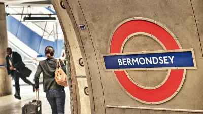
The Safe & the City app uses data to help women find the safest routes in cities.

.jpg)
A new app called Safe & the City seeks to provide women with navigational information by using crime and crowdsourced user data. "It covers personal safety navigation; route sharing; rating and geo-tagging of different aspects of walks; and sharing data with businesses and authorities to help tackle insecurity," writes Mike Butcher.
Users can report incidents and rate the safety of their walks. They will also receive alerts about high-risk areas and notifications about "Safe Sites," organizations in the vicinity with staff trained to handle emergencies and other safety-related situations.
The app is starting by focusing on London, with plans to expand to other cities in the future. "The new features include better navigation with turn-by-turn directions, integration with location startup what3words for greater accuracy and pinned locations of police stations and licensed premises involved in the ground-breaking Ask for Angela campaign in the U.K.," notes Butcher.
FULL STORY: On #IWD2019, Safe & The City launches their new app for women’s safety

The Growing Importance of Location Intelligence
Location intelligence is transforming decision-making, with an increasing number and type of organizations modernizing operations with a geographic approach to problem-solving, planning, and prediction.
Real-Time Art Installation Reveals the Many Dimensions of Data
Using a wagon filled with phones, an artist in Berlin demonstrated the disconnect between data and the real world.
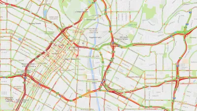
How London's Leading on Transit Data
Transport for London is forging ahead on several projects to collect and use more rider data. One initiative draws on WiFi connections to map users' paths through the London Underground.

Trump Administration Could Effectively End Housing Voucher Program
Federal officials are eyeing major cuts to the Section 8 program that helps millions of low-income households pay rent.

Planetizen Federal Action Tracker
A weekly monitor of how Trump’s orders and actions are impacting planners and planning in America.

Ken Jennings Launches Transit Web Series
The Jeopardy champ wants you to ride public transit.

Rebuilding Smarter: How LA County Is Guiding Fire-Ravaged Communities Toward Resilience
Los Angeles County is leading a coordinated effort to help fire-impacted communities rebuild with resilience by providing recovery resources, promoting fire-wise design, and aligning reconstruction with broader sustainability and climate goals.

When Borders Blur: Regional Collaboration in Action
As regional challenges outgrow city boundaries, “When Borders Blur” explores how cross-jurisdictional collaboration can drive smarter, more resilient urban planning, sharing real-world lessons from thriving partnerships across North America.

Philadelphia Is Expanding its Network of Roundabouts
Roundabouts are widely shown to decrease traffic speed, reduce congestion, and improve efficiency.
Urban Design for Planners 1: Software Tools
This six-course series explores essential urban design concepts using open source software and equips planners with the tools they need to participate fully in the urban design process.
Planning for Universal Design
Learn the tools for implementing Universal Design in planning regulations.
Ada County Highway District
Clanton & Associates, Inc.
Jessamine County Fiscal Court
Institute for Housing and Urban Development Studies (IHS)
City of Grandview
Harvard GSD Executive Education
Toledo-Lucas County Plan Commissions
Salt Lake City
NYU Wagner Graduate School of Public Service