


Metro Map Maker allows users to add, alter, and erase pieces of the WMATA system—or redraw it from scratch.
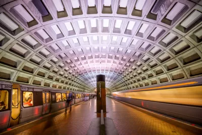
Inspired by a Wired article showcasing "fantasy transit maps," web developer Shannon Turner has created an interactive web tool allowing users to redraw Washington, D.C.'s transit system. DCist's Rachel Kurzius explains:
The first thing visitors see when entering the site is a grid, like graph paper. They add a Metro map, or a Metro map that also includes the forthcoming Purple Line (which is a Maryland Transit Administration project) as a template, or they can start from scratch.
Turner has publicized the code for the site, which is interactive and highly customizable, offering options for station names. It's also shareable, supporting downloads and collaboration. Create your own transit system on Metro Map Maker here.
FULL STORY: Metro Map Maker Helps You Build The WMATA Of Your Dreams

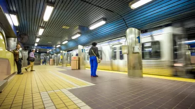
Coming Soon: A New Transit Map for Philadelphia
Transit is getting a new look.
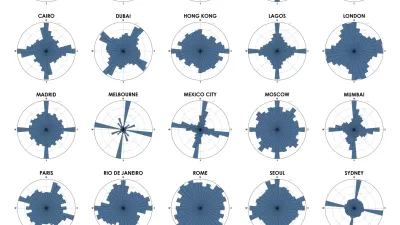
Chart Your City's Street Network to Understand its Logic
The roads in your city might conform to a grid, or they might divert around natural resources or landmarks. A new tool aims to help you visualize the "hidden logic" behind urban growth.
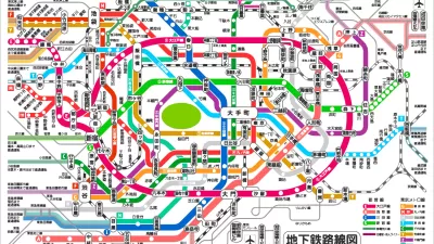
Friday Fun: Choose the Best in the 'World Cup of Transit Maps'
The perennial debate is renewed, and potentially resolved: Which city's metro system has the best transit map?

Alabama: Trump Terminates Settlements for Black Communities Harmed By Raw Sewage
Trump deemed the landmark civil rights agreement “illegal DEI and environmental justice policy.”

Planetizen Federal Action Tracker
A weekly monitor of how Trump’s orders and actions are impacting planners and planning in America.

The 120 Year Old Tiny Home Villages That Sheltered San Francisco’s Earthquake Refugees
More than a century ago, San Francisco mobilized to house thousands of residents displaced by the 1906 earthquake. Could their strategy offer a model for the present?

In Both Crashes and Crime, Public Transportation is Far Safer than Driving
Contrary to popular assumptions, public transportation has far lower crash and crime rates than automobile travel. For safer communities, improve and encourage transit travel.

Report: Zoning Reforms Should Complement Nashville’s Ambitious Transit Plan
Without reform, restrictive zoning codes will limit the impact of the city’s planned transit expansion and could exclude some of the residents who depend on transit the most.

Judge Orders Release of Frozen IRA, IIJA Funding
The decision is a victory for environmental groups who charged that freezing funds for critical infrastructure and disaster response programs caused “real and irreparable harm” to communities.
Urban Design for Planners 1: Software Tools
This six-course series explores essential urban design concepts using open source software and equips planners with the tools they need to participate fully in the urban design process.
Planning for Universal Design
Learn the tools for implementing Universal Design in planning regulations.
Clanton & Associates, Inc.
Jessamine County Fiscal Court
Institute for Housing and Urban Development Studies (IHS)
City of Grandview
Harvard GSD Executive Education
Toledo-Lucas County Plan Commissions
Salt Lake City
NYU Wagner Graduate School of Public Service