


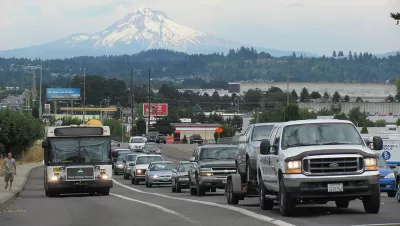
Faced with an uptick in roadway fatalities, Oregon is looking at how to increase safety. But it's concentrating on highways while arterials actually account for the region's most severe crashes.
Over at City Observatory, Joe Cortright has been criticizing plans in Oregon and elsewhere to curb congestion by widening freeways. Here, he points out possibly faulty logic (or mixed priorities) in how Oregon's Department of Transportation is pursuing Vision Zero.
"If we're going to achieve Vision Zero, it really means concentrating our energy and resources on the serious crashes, and not the more numerous, but far less serious ones," Cortright writes. Fatalities on Oregon roads have been on the rise in recent years.
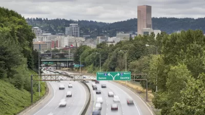
Pointing to a recent ODOT report [pdf] on traffic performance in the Portland region, Cortright says the department's priorities are skewed. "The report makes it clear that ODOT is primarily interested in crashes not because they kill and maim Oregonians, but because they're associated with slower freeway traffic."
More attention should be paid to safety on arterial roadways, Cortright says, than on highways, which are statistically safer in the area. "On average, the region's arterials have five times as many serious crashes per mile traveled as freeways, according to the Metro study, a finding they called 'one of the most conclusive relationships in this study.'" That study, which is several years old, can be found here.
FULL STORY: Dying to widen highways

Environmental Assessment for I-5 Improvement Project in Portland Promises Air, Traffic, Safety Benefits
The environmental assessment for the I-5 Rose Quarter Improvement Project, released on February 15, 2019, promises to be controversial.
Feds Toss the Environmental Assessment for Portland Controversial Freeway Widening Project
It's back to the drawing board for the I-5 Rose Quarter Improvement Project.
Portland and Multnomah County Push for Lower Speed Limits on Bridges
The Portland Bureau of Transportation and Multnomah County agree on a 30 mph speed limit on five downtown bridges, but the state's department of transportation denied the change on two key spans.

Alabama: Trump Terminates Settlements for Black Communities Harmed By Raw Sewage
Trump deemed the landmark civil rights agreement “illegal DEI and environmental justice policy.”

Planetizen Federal Action Tracker
A weekly monitor of how Trump’s orders and actions are impacting planners and planning in America.

The 120 Year Old Tiny Home Villages That Sheltered San Francisco’s Earthquake Refugees
More than a century ago, San Francisco mobilized to house thousands of residents displaced by the 1906 earthquake. Could their strategy offer a model for the present?

Ken Jennings Launches Transit Web Series
The Jeopardy champ wants you to ride public transit.

BLM To Rescind Public Lands Rule
The change will downgrade conservation, once again putting federal land at risk for mining and other extractive uses.

Indy Neighborhood Group Builds Temporary Multi-Use Path
Community members, aided in part by funding from the city, repurposed a vehicle lane to create a protected bike and pedestrian path for the summer season.
Urban Design for Planners 1: Software Tools
This six-course series explores essential urban design concepts using open source software and equips planners with the tools they need to participate fully in the urban design process.
Planning for Universal Design
Learn the tools for implementing Universal Design in planning regulations.
Clanton & Associates, Inc.
Jessamine County Fiscal Court
Institute for Housing and Urban Development Studies (IHS)
City of Grandview
Harvard GSD Executive Education
Toledo-Lucas County Plan Commissions
Salt Lake City
NYU Wagner Graduate School of Public Service