


Google Maps and other navigation and mapping apps have done a lot to inspire and educate people to make the most of their surroundings. New changes to the Google Maps app will add new functionality for those purposes.
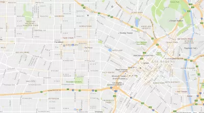
"Starting today we’re rolling out an update to Google Maps on Android that provides helpful everyday info––in real time––at the bottom of your home screen. Just swipe up and you’ll see three tabs that will help you find a nearby restaurant, beat traffic, or catch the next bus," according to a post by Mark Lowe, Google Maps product manager, on the Google blog.
More specifically, the tabs are called Places, Driving, and Transit. While the Places tabs provides new insight for people looking to explore the surrounding area, driving and transit will serve the more mundane moments of moving to and fro—especially during regular trips. Here's how Lowe describes the Transit tab:
With the transit tab, you’ll never have to sprint to the bus again. If you have your home and work addresses saved, you’ll see a recommendation for which bus or train to take, when the next one’s coming, and an ETA for when you’ll arrive at work or home. If you’re headed somewhere else, you can swipe down to find nearby transit stations along with real-time schedules.
In another recent Google Maps function update, Google introduced a new "parking difficulty icon" in Google Maps for Android that alerts users to parking crunches at their destination. That feature is available in 25 metropolitan areas in the United States.
FULL STORY: Get real-time commute info and more in one tap


New Google Map Layer Shows COVID-19 Infection Rates
A new layer showing the seven-day average of confirmed COVID-19 cases started rolling out to Android and iPhones last week.

Analyzing Lynch's City Imageability in the Digital Age
Mahbubur Meenar of Rowan University writes about a recent article he co-authored in the Journal of Planning Education and Research

Like Waze, But for Bikes
The mobile app LaneSpotter, described as a navigation app like Waze but for cyclists, has announced eight cities as the location for a pilot launch.
Manufactured Crisis: Losing the Nation’s Largest Source of Unsubsidized Affordable Housing
Manufactured housing communities have long been an affordable housing option for millions of people living in the U.S., but that affordability is disappearing rapidly. How did we get here?

Americans May Be Stuck — But Why?
Americans are moving a lot less than they once did, and that is a problem. While Yoni Applebaum, in his highly-publicized article Stuck, gets the reasons badly wrong, it's still important to ask: why are we moving so much less than before?

Using Old Oil and Gas Wells for Green Energy Storage
Penn State researchers have found that repurposing abandoned oil and gas wells for geothermal-assisted compressed-air energy storage can boost efficiency, reduce environmental risks, and support clean energy and job transitions.

Greening Oakland’s School Grounds
With help from community partners like the Trust for Public Land, Oakland Unified School District is turning barren, asphalt-covered schoolyards into vibrant, green spaces that support outdoor learning, play, and student well-being.

California Governor Suspends CEQA Reviews for Utilities in Fire Areas
Utility restoration efforts in areas affected by the January wildfires in Los Angeles will be exempt from environmental regulations to speed up the rebuilding of essential infrastructure.

Native American Communities Prepare to Lead on Environmental Stewardship
In the face of federal threats to public lands and conservation efforts, indigenous groups continue to model nature-centered conservation efforts.
Urban Design for Planners 1: Software Tools
This six-course series explores essential urban design concepts using open source software and equips planners with the tools they need to participate fully in the urban design process.
Planning for Universal Design
Learn the tools for implementing Universal Design in planning regulations.
Heyer Gruel & Associates PA
City of Moreno Valley
Institute for Housing and Urban Development Studies (IHS)
City of Grandview
Harvard GSD Executive Education
Salt Lake City
NYU Wagner Graduate School of Public Service
City of Cambridge, Maryland