


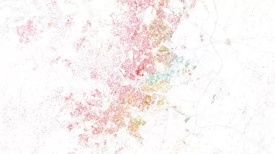
Geographer Duncan Smith mapped the predicted trajectory of worldwide urban growth from 1950 through 2030. Concentric circles of different shades show where and when growth was (or will be) the most dramatic.

CityLab writer Tanvi Misra has high praise for an interactive map of worldwide urban growth created by urban geographer Duncan Smith.
Misra writes, "In its 2014 World Urbanization Prospects report, the UN tracked the populations of major cities from 1950 to 2014, then predicted how these populations would grow (or shrink) up to the year 2030. Using these data, Smith represented each city on his map with a dark blue core, the size of which is proportional to the city's 1950 population. The concentric circles around that core, in lighter blue, vary according to the city's population in 1990, 2015, and 2030."
The result, which is quite pretty to look at, also highlights urbanization's dramatic shift from West to East. Urban China and India, as well as several African cities, stand out as new powerhouses come 2030.
FULL STORY: Mapping 65 Years of Explosive Urban Growth


As Temperatures Increase, Maps Show Sea-Level Rise Will Devastate Cities
Data visualizations illustrate the catastrophic consequences of single-digit global temperature increases.
Visualizing the Growth of the World's Urban Population
An interactive visualization recently released by Unicef presents a startling picture of the world's urban population growth from 1950 to 2050. Mark Wilson deconstructs its implications.
Esri App Makes Data Visualization Easy
A wealth of pre-authored policy maps lets users access data to explore public policy issues.

Study: Maui’s Plan to Convert Vacation Rentals to Long-Term Housing Could Cause Nearly $1 Billion Economic Loss
The plan would reduce visitor accommodation by 25,% resulting in 1,900 jobs lost.

North Texas Transit Leaders Tout Benefits of TOD for Growing Region
At a summit focused on transit-oriented development, policymakers discussed how North Texas’ expanded light rail system can serve as a tool for economic growth.

Why Should We Subsidize Public Transportation?
Many public transit agencies face financial stress due to rising costs, declining fare revenue, and declining subsidies. Transit advocates must provide a strong business case for increasing public transit funding.

How to Make US Trains Faster
Changes to boarding platforms and a switch to electric trains could improve U.S. passenger rail service without the added cost of high-speed rail.

Columbia’s Revitalized ‘Loop’ Is a Hub for Local Entrepreneurs
A focus on small businesses is helping a commercial corridor in Columbia, Missouri thrive.

Invasive Insect Threatens Minnesota’s Ash Forests
The Emerald Ash Borer is a rapidly spreading invasive pest threatening Minnesota’s ash trees, and homeowners are encouraged to plant diverse replacement species, avoid moving ash firewood, and monitor for signs of infestation.
Urban Design for Planners 1: Software Tools
This six-course series explores essential urban design concepts using open source software and equips planners with the tools they need to participate fully in the urban design process.
Planning for Universal Design
Learn the tools for implementing Universal Design in planning regulations.
City of Santa Clarita
Ascent Environmental
Institute for Housing and Urban Development Studies (IHS)
City of Grandview
Harvard GSD Executive Education
Toledo-Lucas County Plan Commissions
Salt Lake City
NYU Wagner Graduate School of Public Service