


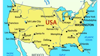
Modern maps are visual representations of millions of points of standardized data.
"As rapid change and urbanization redraw the world, someone must refresh our maps so that the two-dimensional pictures that give us a common sense of where we live reflect the dynamic, shape-shifting places around us," Emily Badger writes.
Over 12,000 new place names were identified in the United States last year, including natural landmarks, such as basins or cliffs, infrastructure, such as crossings and hospitals, and municipalities, such as newly incorporated cities. In the course of just four months this year, over 57,000 new place names in China were identified, standardized, and added to the U.S. government's database of foreign places. These data are maintained by the Board of Geographic Names (BGN), a 125-year old agency tasked with ensuring consistent spelling, transliteration, and description of the place.
As the world's population grows and expands it's terrestrial footprint, the BGN acquires information—sometimes conflicting—about the names, features, and locations of newly identified places, and these data are used to update maps.
The BGN website explains: "The original program of names standardization addressed the complex issues of domestic geographic feature names during the surge of exploration, mining, and settlement of western territories after the American Civil War. Inconsistencies and contradictions among many names, spellings, and applications became a serious problem to surveyors, map makers, and scientists who required uniform, non-conflicting geographic nomenclature." Such problems still occur for places in countries that don't have well-developed cartographic services, such as Afghanistan, or in countries where spellings and transliterations vary across regions and languages.
A quick search for the places in California containing the word "calhoun" returns one canal in Solano County, identified in 1981 as “Calhoun Cut.” A search for lakes in Minnesota crashes the computer. According to the database, there are 32 arches in Missouri, though none appear to be the iconic Gateway Arch of Saint Louis. That's because the monument does not fit the official definition of an arch, which is "a natural arch-like opening in a rock mass." By BGN standards, the 630-foot landmark is technically a park.
Badger explains why this agency's responsibilities are so critical. "Imagine the Army and the Marine Corps talking about the same town with different names in Afghanistan. Or what would happen if no one could agree on what to call Mount Hood. Or how you'd find Reston if no one had ever added it to a map."
FULL STORY: How official mapmakers keep up with a world that won’t stand still


Four New Map Books Reviewed
Looking for the perfect holiday gift for a planner? Check out these new map books.
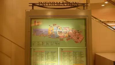
The Future of Mapping is Going Indoors
Cartographers have a new world to map, as technology opens up the interiors of malls, museums, and other large spaces to online exploration.
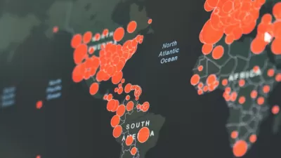
Visualizing the Coronavirus Pandemic
Mapping of the crisis is producing a fascinating and important trove of cartographic records.

Alabama: Trump Terminates Settlements for Black Communities Harmed By Raw Sewage
Trump deemed the landmark civil rights agreement “illegal DEI and environmental justice policy.”

Planetizen Federal Action Tracker
A weekly monitor of how Trump’s orders and actions are impacting planners and planning in America.

The 120 Year Old Tiny Home Villages That Sheltered San Francisco’s Earthquake Refugees
More than a century ago, San Francisco mobilized to house thousands of residents displaced by the 1906 earthquake. Could their strategy offer a model for the present?

In Both Crashes and Crime, Public Transportation is Far Safer than Driving
Contrary to popular assumptions, public transportation has far lower crash and crime rates than automobile travel. For safer communities, improve and encourage transit travel.

Report: Zoning Reforms Should Complement Nashville’s Ambitious Transit Plan
Without reform, restrictive zoning codes will limit the impact of the city’s planned transit expansion and could exclude some of the residents who depend on transit the most.

Judge Orders Release of Frozen IRA, IIJA Funding
The decision is a victory for environmental groups who charged that freezing funds for critical infrastructure and disaster response programs caused “real and irreparable harm” to communities.
Urban Design for Planners 1: Software Tools
This six-course series explores essential urban design concepts using open source software and equips planners with the tools they need to participate fully in the urban design process.
Planning for Universal Design
Learn the tools for implementing Universal Design in planning regulations.
Clanton & Associates, Inc.
Jessamine County Fiscal Court
Institute for Housing and Urban Development Studies (IHS)
City of Grandview
Harvard GSD Executive Education
Toledo-Lucas County Plan Commissions
Salt Lake City
NYU Wagner Graduate School of Public Service