


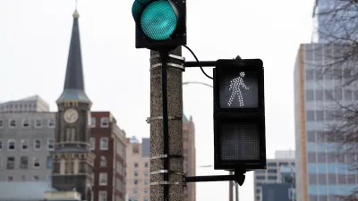
A new study indicates that the safest urban streets have lanes that measure 10-10.5 feet wide. Narrower and wider lanes have higher crash frequencies, and wider lanes have higher crash severity.

The "forgiving highway" approach to traffic engineering holds that wider is safer when it comes to street design. After decades of adherence to these standards, American cities are now criss-crossed by streets with 12-foot wide lanes. As Walkable City author Jeff Speck argued in a column last year, this is actually terrible for public safety and the pedestrian environment.
A new study reinforces the argument that cities need to reconsider lane widths and redesign streets accordingly. In a paper to be presented at the Canadian Institute of Traffic Engineers annual conference, author Dewan Masud Karim presents hard evidence that wider lanes increase risk on city streets.
Karim conducted a wide-ranging review of existing research as well as an examination of crash databases in two cities, taking into consideration 190 randomly selected intersections in Tokyo and 70 in Toronto. Looking at the crash databases, Karim found that collision rates escalate as lane widths exceed about 10.5 feet. Roads with the widest lanes—12 feet or wider—were associated with greater crash rates and higher impact speeds. Karim also found that crash rates rise as lanes become narrower than about 10 feet, though this does not take impact speeds and crash severity into account. He concluded that there is a sweet spot for lane widths on city streets, between about 10 and 10.5 feet.

The rate of side impact crashes is lowest on urban streets with lanes about 10.5 feet wide — much narrower than the standard 12 feet. Graph: Dewan Karim
In Toronto, where traffic lanes are typically wider than in Tokyo, the average crash impact speed is also 34 percent higher, Karim found, suggesting that wider lanes not only result in more crashes but in more severe crashes.
The "inevitable statistical outcome" of the "wider-is-safer approach is loss of precious life, particularly by vulnerable citizens," Karim concluded.
FULL STORY: Compelling Evidence That Wider Lanes Make City Streets More Dangerous


Rethinking Streets: New Report Illustrates Complete Streets Projects
"Rethinking Streets," a new report by the University of Oregon's Sustainable Cities Initiative, provides detailed information on 25 complete streets and streetscaping projects. It is available free in PDF and hard copy format.
Milwaukee Announces 60 Traffic Calming Projects for 2025
The city has successfully reduced traffic deaths and aims to eliminate them completely within the next decade.
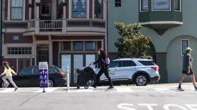
San Francisco Slow Streets Bucks Citywide Trend, Reducing Injuries by 61 Percent
Low-cost interventions aimed at slowing traffic are making a major impact on road safety.

Alabama: Trump Terminates Settlements for Black Communities Harmed By Raw Sewage
Trump deemed the landmark civil rights agreement “illegal DEI and environmental justice policy.”

Planetizen Federal Action Tracker
A weekly monitor of how Trump’s orders and actions are impacting planners and planning in America.

The 120 Year Old Tiny Home Villages That Sheltered San Francisco’s Earthquake Refugees
More than a century ago, San Francisco mobilized to house thousands of residents displaced by the 1906 earthquake. Could their strategy offer a model for the present?

LA’s Tree Emergency Goes Beyond Vandalism
After a vandal destroyed dozens of downtown LA trees, Mayor Karen Bass vowed to replace them. Days later, she slashed the city’s tree budget.

Sacramento Leads Nation With Bus-Mounted Bike Lane Enforcement Cameras
The city is the first to use its bus-mounted traffic enforcement system to cite drivers who park or drive in bike lanes.

Seattle Voters Approve Social Housing Referendum
Voters approved a corporate tax to fund the city’s housing authority despite an opposition campaign funded by Amazon and Microsoft.
Urban Design for Planners 1: Software Tools
This six-course series explores essential urban design concepts using open source software and equips planners with the tools they need to participate fully in the urban design process.
Planning for Universal Design
Learn the tools for implementing Universal Design in planning regulations.
Ada County Highway District
Clanton & Associates, Inc.
Jessamine County Fiscal Court
Institute for Housing and Urban Development Studies (IHS)
City of Grandview
Harvard GSD Executive Education
Toledo-Lucas County Plan Commissions
Salt Lake City
NYU Wagner Graduate School of Public Service