


One of the most valuable graphics in the planner's toolbox is the scale comparison. However, producing such graphics can be a tedious process. A web-based tool utilizing Google Maps seeks to make cartographic “mixtures” much easier to produce.
Henry Grabar looks at MapFrappe, "Kevin Thompson's cartographic mixing engine." The site lets users outline any location on a Google Map and view that outline overlaid on a comparison map that retains the scale of the original shape.
"Once you get tired of outlining your own interests -- your walk to work in London, or Buckingham Palace on your block -- you can check out Drew's MapFrappe blog, which has hundreds of preset outlines to choose from." The site even lets you generate a permanent URL of the comparison to direct others to, or bookmark for later use.
FULL STORY: Compare Cities, Streets and Other Shapes With This Cartographic Mixing Machine


Google Maps Introduces New Transit, EV Features
It will now be easier to find electric car charging stations and transit options.
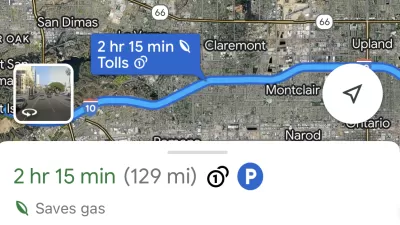
Google Maps Feature Identifies Most Fuel-Efficient Routes
A new feature highlights routes that use the least gas to help users make the most fuel-efficient driving decisions.

Google Maps Now Lets You Feed Your Parking Meter
Google's newest partnership offers contactless parking meter payments and transit fare purchases.

Alabama: Trump Terminates Settlements for Black Communities Harmed By Raw Sewage
Trump deemed the landmark civil rights agreement “illegal DEI and environmental justice policy.”

Planetizen Federal Action Tracker
A weekly monitor of how Trump’s orders and actions are impacting planners and planning in America.

The 120 Year Old Tiny Home Villages That Sheltered San Francisco’s Earthquake Refugees
More than a century ago, San Francisco mobilized to house thousands of residents displaced by the 1906 earthquake. Could their strategy offer a model for the present?

USDOT Repeals Emissions Monitoring Rule
A Biden-era regulation required states to report and plan to reduce transportation-related emissions.

CaBi Breaks Ridership Record — Again
Washington D.C.’s bike share system is extremely popular with both residents and visitors.

San Francisco Opens Park on Former Great Highway
The Sunset Dunes park’s grand opening attracted both fans and detractors.
Urban Design for Planners 1: Software Tools
This six-course series explores essential urban design concepts using open source software and equips planners with the tools they need to participate fully in the urban design process.
Planning for Universal Design
Learn the tools for implementing Universal Design in planning regulations.
Clanton & Associates, Inc.
Jessamine County Fiscal Court
Institute for Housing and Urban Development Studies (IHS)
City of Grandview
Harvard GSD Executive Education
Toledo-Lucas County Plan Commissions
Salt Lake City
NYU Wagner Graduate School of Public Service