


Geomapping data is helping police in cities address problem areas, improve unsafe intersections and improve overall efficiency.
This article from Governing looks at how police departments are taking crime and traffic data and using it to improve their services and save time.
"After mapping, they quickly noticed an overlap: Where crime is high, traffic incidents are often high as well. "You don't hear of walk-by shootings," says Michael Alexander, commander of the Metropolitan Nashville Police Department. "Most of the time the criminal element is either riding or driving in the car."
To address the overlap, the pilot agencies targeted specific areas, and stepped up their police presence and traffic enforcement in these places. The result? Decreases in robberies, vandalism, theft and many other crime categories, and increases in vehicle stops, warnings, traffic citations and DUI/DWI arrests."
FULL STORY: Data-Driven Policing

Beyond Congestion Pricing: Strategies for Revolutionizing Urban Mobility
How cities are leveraging data and technology to improve their transportation networks and reduce traffic.
The Growing Importance of Location Intelligence
Location intelligence is transforming decision-making, with an increasing number and type of organizations modernizing operations with a geographic approach to problem-solving, planning, and prediction.
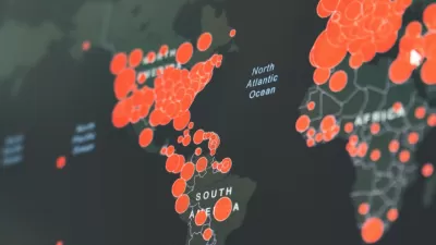
Visualizing the Coronavirus Pandemic
Mapping of the crisis is producing a fascinating and important trove of cartographic records.

Alabama: Trump Terminates Settlements for Black Communities Harmed By Raw Sewage
Trump deemed the landmark civil rights agreement “illegal DEI and environmental justice policy.”

Planetizen Federal Action Tracker
A weekly monitor of how Trump’s orders and actions are impacting planners and planning in America.

The 120 Year Old Tiny Home Villages That Sheltered San Francisco’s Earthquake Refugees
More than a century ago, San Francisco mobilized to house thousands of residents displaced by the 1906 earthquake. Could their strategy offer a model for the present?

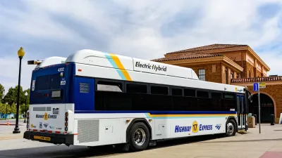
In Both Crashes and Crime, Public Transportation is Far Safer than Driving
Contrary to popular assumptions, public transportation has far lower crash and crime rates than automobile travel. For safer communities, improve and encourage transit travel.

Report: Zoning Reforms Should Complement Nashville’s Ambitious Transit Plan
Without reform, restrictive zoning codes will limit the impact of the city’s planned transit expansion and could exclude some of the residents who depend on transit the most.

Judge Orders Release of Frozen IRA, IIJA Funding
The decision is a victory for environmental groups who charged that freezing funds for critical infrastructure and disaster response programs caused “real and irreparable harm” to communities.
Urban Design for Planners 1: Software Tools
This six-course series explores essential urban design concepts using open source software and equips planners with the tools they need to participate fully in the urban design process.
Planning for Universal Design
Learn the tools for implementing Universal Design in planning regulations.
Clanton & Associates, Inc.
Jessamine County Fiscal Court
Institute for Housing and Urban Development Studies (IHS)
City of Grandview
Harvard GSD Executive Education
Toledo-Lucas County Plan Commissions
Salt Lake City
NYU Wagner Graduate School of Public Service