


The street grid of New York City was born 200 years ago in an early map of the city.
"Two hundred years ago on Tuesday, the city's street commissioners certified the no-frills street matrix that heralded New York's transformation into the City of Angles - the rigid 90-degree grid that spurred unprecedented development, gave birth to vehicular gridlock and defiant jaywalking, and spawned a new breed of entrepreneurs who would exponentially raise the value of Manhattan's real estate.
Today, debate endures about the grid, which mapped out 11 major avenues and 155 crosstown streets along which modern Manhattan would rise."
The grid was certified by the city's street commissioners on March 22, 1811.
FULL STORY: 200th Birthday for the Map That Made New York

Interactive Map Tracks Growth of Manhattan Grid
This interactive map from The New York Times overlays historic maps with modern-day maps of the city, and shows how the city and its street grid has developed.
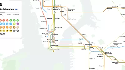
The New New York Subway Map Works in Real Time
There's a new chapter, and maybe an end, for the "Great Subway Map Debate."

Friday Eye Candy: A Sorely-Needed Map of New York City Neighborhoods
Neighborhoods don't get the same official boundaries as cities, counties, states, and countries. So how do we know where one neighborhood ends and another begins?

Trump Administration Could Effectively End Housing Voucher Program
Federal officials are eyeing major cuts to the Section 8 program that helps millions of low-income households pay rent.

Planetizen Federal Action Tracker
A weekly monitor of how Trump’s orders and actions are impacting planners and planning in America.

Ken Jennings Launches Transit Web Series
The Jeopardy champ wants you to ride public transit.

Crime Continues to Drop on Philly, San Francisco Transit Systems
SEPTA and BART both saw significant declines in violent crime in the first quarter of 2025.

How South LA Green Spaces Power Community Health and Hope
Green spaces like South L.A. Wetlands Park are helping South Los Angeles residents promote healthy lifestyles, build community, and advocate for improvements that reflect local needs in historically underserved neighborhoods.

Sacramento Plans ‘Quick-Build’ Road Safety Projects
The city wants to accelerate small-scale safety improvements that use low-cost equipment to make an impact at dangerous intersections.
Urban Design for Planners 1: Software Tools
This six-course series explores essential urban design concepts using open source software and equips planners with the tools they need to participate fully in the urban design process.
Planning for Universal Design
Learn the tools for implementing Universal Design in planning regulations.
Heyer Gruel & Associates PA
Ada County Highway District
Institute for Housing and Urban Development Studies (IHS)
City of Grandview
Harvard GSD Executive Education
Toledo-Lucas County Plan Commissions
Salt Lake City
NYU Wagner Graduate School of Public Service