


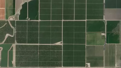
The U.S. Geological Survey has released a highly detailed map of vegetative land-cover in America, which is expected to assist officials in efforts to preserve wildlife habitats.
The map is available online and also shows the extent of human land-use in the U.S.
"The GAP national land cover data, based on the NatureServe Ecological Systems Classification, is the most detailed, consistent map of vegetative associations ever available for the United States and will help facilitate the planning and management of biological diversity on a regional and national scale.
...The final version of the landcover map contains 551 Ecological Systems and modified Ecological Systems (the modified ecological systems represent 32 land use classes which depict developed and/or disturbed land cover classes). The map combines data from previous GAP projects in the Southwest, Southeast, and Northwest United States with recently updated California data. For areas of the continental United States where ecological system-level GAP data has not yet been developed, data from the LANDFIRE project compiled by Landscope was used. This allows for the construction of a seamless representation of ecological system distributions across the continental United States."
FULL STORY: First detailed national map of land-cover vegetation released


How the National Park Service Uses GIS
A new book demonstrates how the National Park Service uses GIS technology to meet its mission and showcases a selection of maps used for effectively managing national parks.
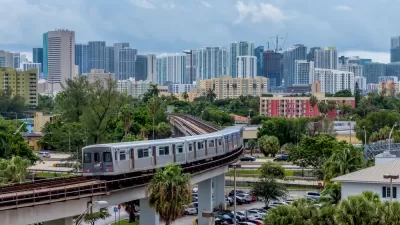
New Tool Puts Miami Development Opportunities on the Map
There's plenty of vacant or underutilized land to be found in Miami-Dade County, if you know where and how to look.
Facebook AI Maps Population Density
Facebook expects to release its worldwide maps of human density in the coming months—potential applications will likely be somewhere on the spectrum between humanitarian and commercial.

Trump Administration Could Effectively End Housing Voucher Program
Federal officials are eyeing major cuts to the Section 8 program that helps millions of low-income households pay rent.

Planetizen Federal Action Tracker
A weekly monitor of how Trump’s orders and actions are impacting planners and planning in America.

Ken Jennings Launches Transit Web Series
The Jeopardy champ wants you to ride public transit.

Crime Continues to Drop on Philly, San Francisco Transit Systems
SEPTA and BART both saw significant declines in violent crime in the first quarter of 2025.

How South LA Green Spaces Power Community Health and Hope
Green spaces like South L.A. Wetlands Park are helping South Los Angeles residents promote healthy lifestyles, build community, and advocate for improvements that reflect local needs in historically underserved neighborhoods.

Sacramento Plans ‘Quick-Build’ Road Safety Projects
The city wants to accelerate small-scale safety improvements that use low-cost equipment to make an impact at dangerous intersections.
Urban Design for Planners 1: Software Tools
This six-course series explores essential urban design concepts using open source software and equips planners with the tools they need to participate fully in the urban design process.
Planning for Universal Design
Learn the tools for implementing Universal Design in planning regulations.
Heyer Gruel & Associates PA
Ada County Highway District
Institute for Housing and Urban Development Studies (IHS)
City of Grandview
Harvard GSD Executive Education
Toledo-Lucas County Plan Commissions
Salt Lake City
NYU Wagner Graduate School of Public Service