


Search giant Google has mapped the location of every WiFi network in Britain. Some say the collection of this information is a violation of privacy.
"The information was collected by radio aerials on their Street View cars, which have now photographed almost every home in the country.
The data is then used on Google's Maps for Mobile application to locate mobile phones such as iPhones in order for users to access information relevant to the area such as restaurants, cinemas, theatres, shops and hotels."
Google defends its mapping project, which they say will help spread data about places to mobile devices. But locals are still upset that the company secretly collected the data.
FULL STORY: Google has mapped every WiFi network in Britain

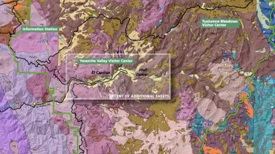
The Growing Importance of Location Intelligence
Location intelligence is transforming decision-making, with an increasing number and type of organizations modernizing operations with a geographic approach to problem-solving, planning, and prediction.
Real-Time Art Installation Reveals the Many Dimensions of Data
Using a wagon filled with phones, an artist in Berlin demonstrated the disconnect between data and the real world.

An App That Maps Safer Cities for Women
The Safe & the City app uses data to help women find the safest routes in cities.

Study: Maui’s Plan to Convert Vacation Rentals to Long-Term Housing Could Cause Nearly $1 Billion Economic Loss
The plan would reduce visitor accommodation by 25,% resulting in 1,900 jobs lost.

Alabama: Trump Terminates Settlements for Black Communities Harmed By Raw Sewage
Trump deemed the landmark civil rights agreement “illegal DEI and environmental justice policy.”

North Texas Transit Leaders Tout Benefits of TOD for Growing Region
At a summit focused on transit-oriented development, policymakers discussed how North Texas’ expanded light rail system can serve as a tool for economic growth.

San Diego County Sees a Rise in Urban Coyotes
San Diego County experiences a rise in urban coyotes, as sightings become prevalent throughout its urban neighbourhoods and surrounding areas.

Los Angeles County Invests in Wildfire Recovery for Parks, Trails, and Open Space
The $4.25 million RESTORE Program supports the recovery of parks, trails, and open spaces damaged by the January 2025 wildfires through targeted grants that promote community healing, wildfire resilience, and equitable access to nature.

Nevada Bills Aim to Establish Home Insurance Assurance Amidst Wildfire Risk
Republican sponsor hopes the FAIR plan would be “a true market of last resort.”
Urban Design for Planners 1: Software Tools
This six-course series explores essential urban design concepts using open source software and equips planners with the tools they need to participate fully in the urban design process.
Planning for Universal Design
Learn the tools for implementing Universal Design in planning regulations.
Alamo Area Metropolitan Planning Organization
City of Santa Clarita
Institute for Housing and Urban Development Studies (IHS)
City of Grandview
Harvard GSD Executive Education
Toledo-Lucas County Plan Commissions
Salt Lake City
NYU Wagner Graduate School of Public Service