


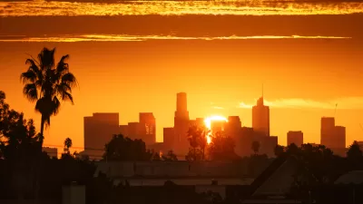
In an effort to get a more precise look at the city and its distinct neighborhoods, the Los Angeles Times is starting a collaborative mapping project to set clear and adaptable boundaries for L.A.'s neighborhoods.
"Los Angeles is a city that remakes itself constantly, so drawing boundaries for communities can be perilous. City officials are happy to designate community names, but have never been willing to set borders. But we at The Times are preparing to do just that."
"The initial cut of Mapping L.A.'s neighborhoods was based on census tracts. These areas, drawn by the U.S. Census Bureau for tabulating demographic information, allow us to compile statistical profiles of L.A. communities. Unfortunately, they are frequently out of sync with the geographical, historic and socioeconomic associations that define communities."
"Consequently, we've adjusted the lines in many cases. We've done so by moving individual city blocks from one census tract to another. In each instance, we've adjusted the census data in proportion to the population of each block."
"Because L.A. is always changing, Mapping L.A. will change with it. As communities gain in size or importance, or diminish, we'll reflect those changes in these maps. But, in contrast to the past, the boundaries we recognize today will not be lost. Every time we move a city block from one community to another, we'll keep a record of the original map that can be republished any time it's needed. We'll also keep a log of changes on the site for use by anyone seeking to trace the city's evolution. "
FULL STORY: Mapping L.A.

L.A.'s Neighborhoods Defined and Mapped
After months of input on boundaries from readers, the Los Angeles Times has released its map of neighborhoods in the city.
Mapping Heat Inequality
A new mapping tool underscores inequities in infrastructure that lead to higher rates of heat-related illnesses in low-income neighborhoods.
Poets Describe Their Neighborhoods
The city of L.A.'s poets write about their neighborhoods.

Alabama: Trump Terminates Settlements for Black Communities Harmed By Raw Sewage
Trump deemed the landmark civil rights agreement “illegal DEI and environmental justice policy.”

Planetizen Federal Action Tracker
A weekly monitor of how Trump’s orders and actions are impacting planners and planning in America.

The 120 Year Old Tiny Home Villages That Sheltered San Francisco’s Earthquake Refugees
More than a century ago, San Francisco mobilized to house thousands of residents displaced by the 1906 earthquake. Could their strategy offer a model for the present?

In Both Crashes and Crime, Public Transportation is Far Safer than Driving
Contrary to popular assumptions, public transportation has far lower crash and crime rates than automobile travel. For safer communities, improve and encourage transit travel.

Report: Zoning Reforms Should Complement Nashville’s Ambitious Transit Plan
Without reform, restrictive zoning codes will limit the impact of the city’s planned transit expansion and could exclude some of the residents who depend on transit the most.

Judge Orders Release of Frozen IRA, IIJA Funding
The decision is a victory for environmental groups who charged that freezing funds for critical infrastructure and disaster response programs caused “real and irreparable harm” to communities.
Urban Design for Planners 1: Software Tools
This six-course series explores essential urban design concepts using open source software and equips planners with the tools they need to participate fully in the urban design process.
Planning for Universal Design
Learn the tools for implementing Universal Design in planning regulations.
Clanton & Associates, Inc.
Jessamine County Fiscal Court
Institute for Housing and Urban Development Studies (IHS)
City of Grandview
Harvard GSD Executive Education
Toledo-Lucas County Plan Commissions
Salt Lake City
NYU Wagner Graduate School of Public Service