


The city wants to eliminate traffic deaths by 2045.
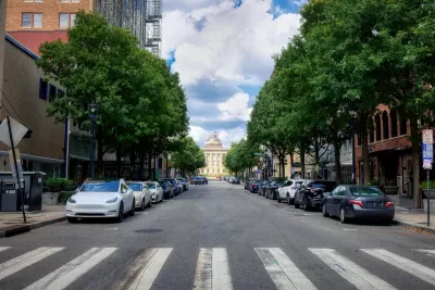
Raleigh, North Carolina announced its first Vision Zero plan, a Safe Streets for All strategy aimed at eliminating traffic deaths by 2045 and “shaping a transportation network that reflects the concerns and needs of its citizens.”
As Adrianne Sinclair explains in Hoodline, the plan includes proposals to improve bike and pedestrian infrastructure and make the city’s transportation system “more equitable and user-friendly.”
The program is funded in part by the federal Safe Streets and Roads for All (SS4A) program. According to the city, the plan will identify ways to work toward reducing fatalities and serious injuries by 25 percent every five years and completely by 2045. “As a key component of this plan, the SS4A team will conduct a citywide analysis to identify high-injury and high-risk areas for road users. Through this analysis, the team will utilize a data-driven approach to implement high-impact safety improvements at critical crash hotspots.”
FULL STORY: Raleigh Seeks Community Feedback on Safe Streets for All Plan with Public Meetings and Online Survey

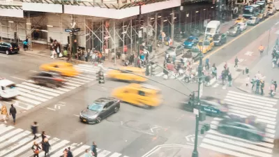
NYC Pedestrian Deaths Rose in 2024
The city’s Vision Zero efforts seem to have stalled.
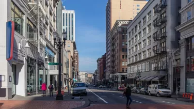
Portland Traffic Deaths Surpass 2022 Number
This year, 69 people have died in traffic crashes in Portland, Oregon, nearly twice as many as in 2018, when the city began its Vision Zero program.
NYC Sees 127 Traffic Deaths in First Half of 2024
The number is the highest since the city pledged to end traffic deaths through Vision Zero policies a decade ago.

Alabama: Trump Terminates Settlements for Black Communities Harmed By Raw Sewage
Trump deemed the landmark civil rights agreement “illegal DEI and environmental justice policy.”

Planetizen Federal Action Tracker
A weekly monitor of how Trump’s orders and actions are impacting planners and planning in America.

The 120 Year Old Tiny Home Villages That Sheltered San Francisco’s Earthquake Refugees
More than a century ago, San Francisco mobilized to house thousands of residents displaced by the 1906 earthquake. Could their strategy offer a model for the present?

Ken Jennings Launches Transit Web Series
The Jeopardy champ wants you to ride public transit.

BLM To Rescind Public Lands Rule
The change will downgrade conservation, once again putting federal land at risk for mining and other extractive uses.

Indy Neighborhood Group Builds Temporary Multi-Use Path
Community members, aided in part by funding from the city, repurposed a vehicle lane to create a protected bike and pedestrian path for the summer season.
Urban Design for Planners 1: Software Tools
This six-course series explores essential urban design concepts using open source software and equips planners with the tools they need to participate fully in the urban design process.
Planning for Universal Design
Learn the tools for implementing Universal Design in planning regulations.
Clanton & Associates, Inc.
Jessamine County Fiscal Court
Institute for Housing and Urban Development Studies (IHS)
City of Grandview
Harvard GSD Executive Education
Toledo-Lucas County Plan Commissions
Salt Lake City
NYU Wagner Graduate School of Public Service