


The Traffic Monitoring site uses community-collected speed and volume data to reveal traffic patterns on local roads.
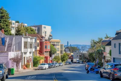
A new online tool compiles data from window-mounted computers that collect traffic data, reports Roger Rudick in Streetsblog San Francisco.
The tool brings together data from individually owned Telraam devices in the San Francisco Bay Area to allow road safety advocates to gain a better understanding of street safety and conditions.
As Rudick explains, “Residents on Lake Street in San Francisco purchased and installed the first Telraam sensors in North America and have sent several requests to SFMTA leadership begging the agency to acknowledge Telraam's data which shows daily vehicle volume and speeds exceeding thresholds set for Lake Street.” The city did not take action, saying it cannot use community-collected data to inform its decisions.
Now, the Traffic Monitoring map offers “a faster and easier way to interact with Telraam’s data so advocates can quickly pull insights from it.” Its creator, Stephen Braitsch, hopes the data will help move the needle on street safety.
FULL STORY: New ‘Traffic Monitoring’ Site Consolidates Data on Car Volumes & Speeds


‘Complete Streets’ Webpage Deleted in Federal Purge
Basic resources and information on building bike lanes and sidewalks, formerly housed on the government’s Complete Streets website, are now gone.

NYC Congestion Pricing May Be Saving Lives
According to preliminary data, crashes and injuries dropped dramatically within the city’s new congestion relief zone.
California Adds Complete Streets to Transportation Funding Guidelines
The state transportation commission previously declined to include bike and pedestrian infrastructure in its updated funding guidelines, despite a new state law requiring Complete Streets efforts in all Caltrans projects.

Alabama: Trump Terminates Settlements for Black Communities Harmed By Raw Sewage
Trump deemed the landmark civil rights agreement “illegal DEI and environmental justice policy.”

Planetizen Federal Action Tracker
A weekly monitor of how Trump’s orders and actions are impacting planners and planning in America.

The 120 Year Old Tiny Home Villages That Sheltered San Francisco’s Earthquake Refugees
More than a century ago, San Francisco mobilized to house thousands of residents displaced by the 1906 earthquake. Could their strategy offer a model for the present?

In Both Crashes and Crime, Public Transportation is Far Safer than Driving
Contrary to popular assumptions, public transportation has far lower crash and crime rates than automobile travel. For safer communities, improve and encourage transit travel.

Report: Zoning Reforms Should Complement Nashville’s Ambitious Transit Plan
Without reform, restrictive zoning codes will limit the impact of the city’s planned transit expansion and could exclude some of the residents who depend on transit the most.

Judge Orders Release of Frozen IRA, IIJA Funding
The decision is a victory for environmental groups who charged that freezing funds for critical infrastructure and disaster response programs caused “real and irreparable harm” to communities.
Urban Design for Planners 1: Software Tools
This six-course series explores essential urban design concepts using open source software and equips planners with the tools they need to participate fully in the urban design process.
Planning for Universal Design
Learn the tools for implementing Universal Design in planning regulations.
Clanton & Associates, Inc.
Jessamine County Fiscal Court
Institute for Housing and Urban Development Studies (IHS)
City of Grandview
Harvard GSD Executive Education
Toledo-Lucas County Plan Commissions
Salt Lake City
NYU Wagner Graduate School of Public Service