


MIT researchers have developed a groundbreaking AI-powered tool that integrates physics-based models to generate realistic satellite images of future flooding, offering communities a powerful way to visualize and prepare for disasters.
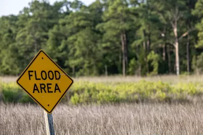
Massachusetts Institute of Technology (MIT) scientists have developed an innovative method that combines generative artificial intelligence (AI) with a physics-based flood model to create realistic satellite images of future flooding events. This tool, called the "Earth Intelligence Engine," generates detailed, birds-eye-view visuals of regions expected to flood based on the strength and trajectory of approaching storms. As a proof of concept, the team tested the method on Houston, simulating flooding scenarios similar to Hurricane Harvey in 2017. The AI-generated images that incorporated the physics-based flood model proved more accurate and reliable than those generated by AI alone, which often included errors like flooding in areas of high elevation.
The method uses a conditional generative adversarial network (GAN) to produce realistic images by training two neural networks: one generates synthetic satellite images, and the other evaluates their accuracy against real images. While traditional GAN models risk "hallucinations," or inaccuracies in their results, the integration of physics-based parameters significantly reduces these errors. This enhanced approach provides a trustworthy visualization tool that could help policymakers and residents better understand potential flooding risks, making it more emotionally engaging and actionable than standard color-coded flood maps.
The research highlights the importance of pairing AI with trustworthy data sources, particularly in risk-sensitive scenarios like natural disasters. By visualizing potential flooding before a hurricane hits, this technology has the potential to enhance public preparedness and decision-making, such as evacuation planning. While further training on diverse satellite images is needed to apply the model to other regions, the method demonstrates how AI, combined with physics, can support community-level decision-making and potentially save lives.
FULL STORY: New AI tool generates realistic satellite images of future flooding


Rising Above: Innovative Solutions for Waikīkī’s Sea-Level Challenges
The University of Hawaiʻi at Mānoa’s award-winning Waikīkī sea-level rise adaptation project combines science, architecture, and community input to create scalable solutions for climate resilience and coastal flood mitigation.
FEMA Rule Calls for Updated Flood Modeling
Agency-funded projects will be required to be elevated at least 2 feet above the projected local flood level.

3D Modeling Aids in Predicting Hurricane Damage
Texas researchers are testing the tool in Galveston, where Hurricane Ike caused billions in damage in 2008.
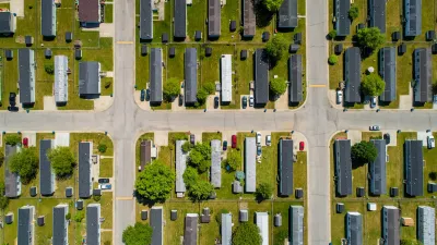
Manufactured Crisis: Losing the Nation’s Largest Source of Unsubsidized Affordable Housing
Manufactured housing communities have long been an affordable housing option for millions of people living in the U.S., but that affordability is disappearing rapidly. How did we get here?

Americans May Be Stuck — But Why?
Americans are moving a lot less than they once did, and that is a problem. While Yoni Applebaum, in his highly-publicized article Stuck, gets the reasons badly wrong, it's still important to ask: why are we moving so much less than before?

Research Shows More Roads = More Driving
A national study shows, once again, that increasing road supply induces additional vehicle travel, particularly over the long run.

How Protecting Kauaʻi’s Forests Safeguards Fresh Water
A University of Hawaiʻi study shows that protecting Kauaʻi’s native forests from invasive species significantly boosts groundwater recharge, making it a cost-effective strategy to secure fresh water and enhance climate resilience.

Gary, Indiana to Expand Transit Service, Bike Share
The city plans to launch a bike share system in April and expand service on its bus routes.

Pittsburgh Rolls Out Electric School Buses
Pittsburgh Public Schools has launched its first electric school buses, with plans to fully electrify its fleet over the next 14 months, aiming to create a cleaner, more sustainable transportation system supported by new charging infrastructure.
Urban Design for Planners 1: Software Tools
This six-course series explores essential urban design concepts using open source software and equips planners with the tools they need to participate fully in the urban design process.
Planning for Universal Design
Learn the tools for implementing Universal Design in planning regulations.
City of Moreno Valley
Institute for Housing and Urban Development Studies (IHS)
City of Grandview
Harvard GSD Executive Education
NYU Wagner Graduate School of Public Service
City of Cambridge, Maryland
Newport County Development Council: Connect Greater Newport