


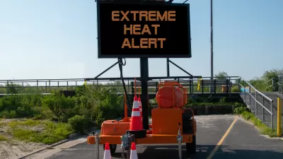
A new mapping tool underscores inequities in infrastructure that lead to higher rates of heat-related illnesses in low-income neighborhoods.

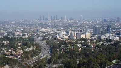
A new mapping tool from UCLA that tracks heat-related emergency room visits in Los Angeles County “highlights a stark disparity between wealthier, leafier neighborhoods and those that are home to fewer trees, more concrete and higher occurrences of underlying health issues.” Hayley Smith reports on the map’s findings for the Los Angeles Times. “Although extreme heat has become the leading cause of weather-related deaths in the United States, a Times investigation found that such deaths are chronically undercounted.”
According to the map, some parts of Los Angeles see as much as four times as many emergency room visits due to extreme heat. “The parts of L.A. County that show higher rates of ER visits during heat days include the South L.A. corridor down to the ports, the San Pedro area, and the northwest Valley, especially San Fernando and Pacoima, said Eisenman, who is also a professor at the UCLA Fielding School of Public Health.”
A county Climate Vulnerability Assessment released last fall found that extreme heat could increase by as much as ten times in the next two decades. “[David Eisenman, co-director of the UCLA Center for Public Health and Disasters] said the findings in L.A. County are in some ways not surprising in that they echo the ‘decades of redlining’ that have led to differences in shade, access to air conditioning and even base-line health levels in some L.A. communities. Redlining was the institutional practice of denying homeownership and financial services to residents based on race.” Eisenman also points out that heat exacerbates underlying conditions like diabetes and heart disease.
The city of L.A.’s new “chief heat officer,” Marta Segura, says her office is working to create an early warning system for heat waves and implement long-term strategies for reducing heat exposure, including planting more trees and updating building codes.
FULL STORY: How dangerous is extreme heat in your neighborhood? This map tells you

Updating LA’s Tree Rules Could Bring More Shade to Underserved Neighborhoods
A new USC study finds that relaxing Los Angeles’ outdated tree planting guidelines could significantly expand urban tree canopy and reduce shade disparities in lower-income neighborhoods, though infrastructure investments are also needed.
How Extreme Heat Impacts Heart Health
A higher number of high heat days correlates with more cardiovascular deaths, according to new research.

To Combat Rising Heat Deaths, Phoenix Creates Heat Response and Mitigation Office
As more extreme temperatures lead to an alarming rise in heat-related deaths across the country, Phoenix is taking action with the nation's first public heat response office.

Alabama: Trump Terminates Settlements for Black Communities Harmed By Raw Sewage
Trump deemed the landmark civil rights agreement “illegal DEI and environmental justice policy.”

Planetizen Federal Action Tracker
A weekly monitor of how Trump’s orders and actions are impacting planners and planning in America.

The 120 Year Old Tiny Home Villages That Sheltered San Francisco’s Earthquake Refugees
More than a century ago, San Francisco mobilized to house thousands of residents displaced by the 1906 earthquake. Could their strategy offer a model for the present?

In Both Crashes and Crime, Public Transportation is Far Safer than Driving
Contrary to popular assumptions, public transportation has far lower crash and crime rates than automobile travel. For safer communities, improve and encourage transit travel.

Report: Zoning Reforms Should Complement Nashville’s Ambitious Transit Plan
Without reform, restrictive zoning codes will limit the impact of the city’s planned transit expansion and could exclude some of the residents who depend on transit the most.

Judge Orders Release of Frozen IRA, IIJA Funding
The decision is a victory for environmental groups who charged that freezing funds for critical infrastructure and disaster response programs caused “real and irreparable harm” to communities.
Urban Design for Planners 1: Software Tools
This six-course series explores essential urban design concepts using open source software and equips planners with the tools they need to participate fully in the urban design process.
Planning for Universal Design
Learn the tools for implementing Universal Design in planning regulations.
Clanton & Associates, Inc.
Jessamine County Fiscal Court
Institute for Housing and Urban Development Studies (IHS)
City of Grandview
Harvard GSD Executive Education
Toledo-Lucas County Plan Commissions
Salt Lake City
NYU Wagner Graduate School of Public Service